You are here: Home > Network List > CN - Canadian National Seismograph Network Stations List
> Station INK INUVIK, NT > Earthquake Result Viewer
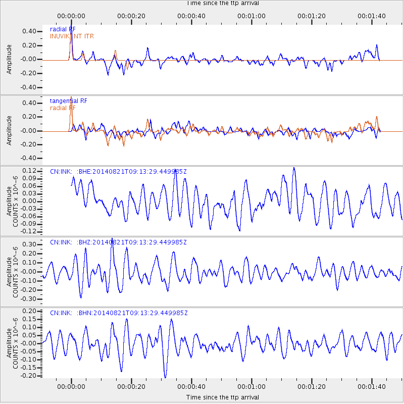
INK INUVIK, NT - Earthquake Result Viewer
*The percent match for this event was below the threshold and hence no stack was calculated.
| Earthquake location: |
Tonga Islands Region |
| Earthquake latitude/longitude: |
-17.6/-172.9 |
| Earthquake time(UTC): |
2014/08/21 (233) 09:01:00 GMT |
| Earthquake Depth: |
10 km |
| Earthquake Magnitude: |
5.3 MW, 5.1 mb |
| Earthquake Catalog/Contributor: |
ISC/ISC |
|
| Network: |
CN Canadian National Seismograph Network |
| Station: |
INK INUVIK, NT |
| Lat/Lon: |
68.31 N/133.53 W |
| Elevation: |
44 m |
|
| Distance: |
90.2 deg |
| Az: |
13.635 deg |
| Baz: |
217.22 deg |
| Ray Param: |
$rayparam |
*The percent match for this event was below the threshold and hence was not used in the summary stack. |
|
| Radial Match: |
68.49738 % |
| Radial Bump: |
400 |
| Transverse Match: |
46.39679 % |
| Transverse Bump: |
400 |
| SOD ConfigId: |
3390531 |
| Insert Time: |
2019-04-13 12:51:04.880 +0000 |
| GWidth: |
2.5 |
| Max Bumps: |
400 |
| Tol: |
0.001 |
|
Signal To Noise
| Channel | StoN | STA | LTA |
| CN:INK: :BHZ:20140821T09:13:29.449985Z | 3.4183683 | 1.5320589E-7 | 4.4818425E-8 |
| CN:INK: :BHN:20140821T09:13:29.449985Z | 1.5583086 | 6.142289E-8 | 3.941638E-8 |
| CN:INK: :BHE:20140821T09:13:29.449985Z | 1.3470632 | 5.7806492E-8 | 4.2912976E-8 |
| Arrivals |
| Ps | |
| PpPs | |
| PsPs/PpSs | |


