You are here: Home > Network List > GS - US Geological Survey Networks Stations List
> Station KAN10 Keim Farm > Earthquake Result Viewer
KAN10 Keim Farm - Earthquake Result Viewer
*The percent match for this event was below the threshold and hence no stack was calculated.
| Earthquake location: |
Tonga Islands Region |
| Earthquake latitude/longitude: |
-17.6/-172.9 |
| Earthquake time(UTC): |
2014/08/21 (233) 09:01:00 GMT |
| Earthquake Depth: |
10 km |
| Earthquake Magnitude: |
5.3 MW, 5.1 mb |
| Earthquake Catalog/Contributor: |
ISC/ISC |
|
| Network: |
GS US Geological Survey Networks |
| Station: |
KAN10 Keim Farm |
| Lat/Lon: |
37.12 N/98.10 W |
| Elevation: |
417 m |
|
| Distance: |
88.9 deg |
| Az: |
50.48 deg |
| Baz: |
247.03 deg |
| Ray Param: |
$rayparam |
*The percent match for this event was below the threshold and hence was not used in the summary stack. |
|
| Radial Match: |
76.99118 % |
| Radial Bump: |
371 |
| Transverse Match: |
65.51652 % |
| Transverse Bump: |
400 |
| SOD ConfigId: |
3390531 |
| Insert Time: |
2019-04-13 12:51:33.583 +0000 |
| GWidth: |
2.5 |
| Max Bumps: |
400 |
| Tol: |
0.001 |
|
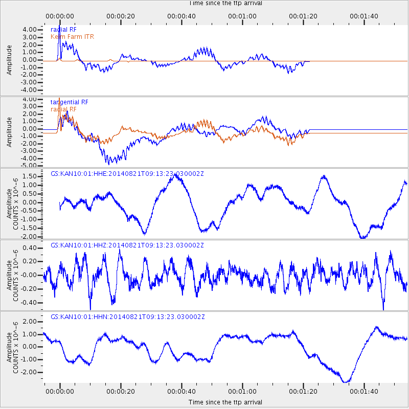
Signal To Noise
| Channel | StoN | STA | LTA |
| GS:KAN10:01:HHZ:20140821T09:13:23.030002Z | 0.97308713 | 1.0310808E-7 | 1.05959764E-7 |
| GS:KAN10:01:HHN:20140821T09:13:23.030002Z | 1.0799878 | 9.185552E-7 | 8.5052375E-7 |
| GS:KAN10:01:HHE:20140821T09:13:23.030002Z | 1.8219291 | 7.133463E-7 | 3.9153352E-7 |
| Arrivals |
| Ps | |
| PpPs | |
| PsPs/PpSs | |


