You are here: Home > Network List > US - United States National Seismic Network Stations List
> Station WUAZ Wupatki, Arizona, USA > Earthquake Result Viewer
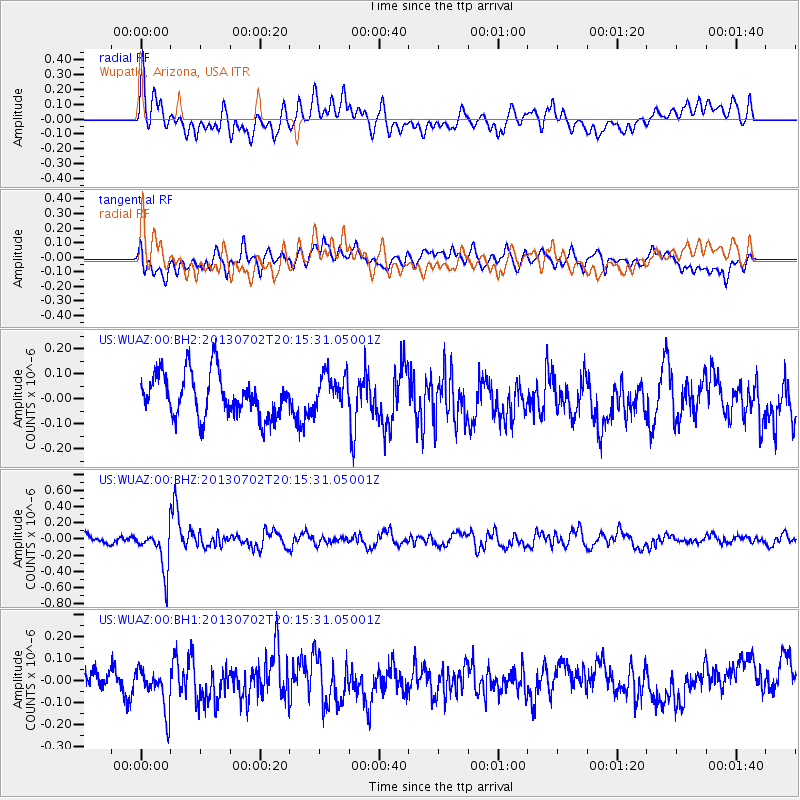
WUAZ Wupatki, Arizona, USA - Earthquake Result Viewer
*The percent match for this event was below the threshold and hence no stack was calculated.
| Earthquake location: |
Jujuy Province, Argentina |
| Earthquake latitude/longitude: |
-23.9/-66.5 |
| Earthquake time(UTC): |
2013/07/02 (183) 20:04:55 GMT |
| Earthquake Depth: |
199 km |
| Earthquake Magnitude: |
5.6 MW, 5.7 MW |
| Earthquake Catalog/Contributor: |
NEIC PDE/NEIC PDE-W |
|
| Network: |
US United States National Seismic Network |
| Station: |
WUAZ Wupatki, Arizona, USA |
| Lat/Lon: |
35.52 N/111.37 W |
| Elevation: |
1592 m |
|
| Distance: |
72.7 deg |
| Az: |
322.945 deg |
| Baz: |
137.443 deg |
| Ray Param: |
$rayparam |
*The percent match for this event was below the threshold and hence was not used in the summary stack. |
|
| Radial Match: |
49.111538 % |
| Radial Bump: |
400 |
| Transverse Match: |
40.06384 % |
| Transverse Bump: |
400 |
| SOD ConfigId: |
512894 |
| Insert Time: |
2013-09-15 13:00:05.186 +0000 |
| GWidth: |
2.5 |
| Max Bumps: |
400 |
| Tol: |
0.001 |
|
Signal To Noise
| Channel | StoN | STA | LTA |
| US:WUAZ:00:BHZ:20130702T20:15:31.05001Z | 3.9260335 | 2.5522525E-7 | 6.500843E-8 |
| US:WUAZ:00:BH1:20130702T20:15:31.05001Z | 1.7498541 | 9.7740056E-8 | 5.585612E-8 |
| US:WUAZ:00:BH2:20130702T20:15:31.05001Z | 0.84966403 | 7.2499354E-8 | 8.532709E-8 |
| Arrivals |
| Ps | |
| PpPs | |
| PsPs/PpSs | |


