You are here: Home > Network List > UW - Pacific Northwest Regional Seismic Network Stations List
> Station LTY Liberty (broad-band) > Earthquake Result Viewer
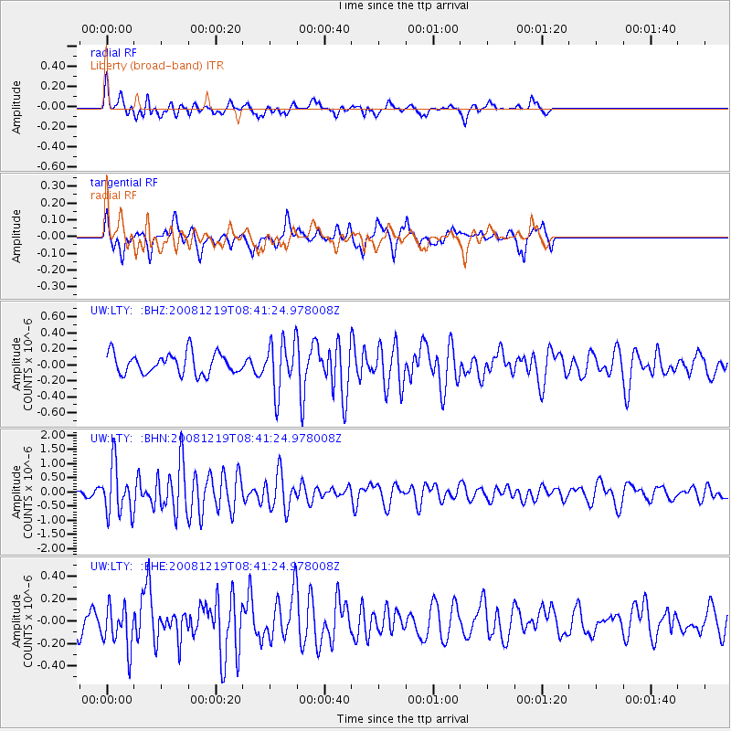
LTY Liberty (broad-band) - Earthquake Result Viewer
*The percent match for this event was below the threshold and hence no stack was calculated.
| Earthquake location: |
Northern Mid-Atlantic Ridge |
| Earthquake latitude/longitude: |
47.0/-27.3 |
| Earthquake time(UTC): |
2008/12/19 (354) 08:31:51 GMT |
| Earthquake Depth: |
2.0 km |
| Earthquake Magnitude: |
5.8 MB, 5.6 MS, 5.9 MW, 5.8 MW |
| Earthquake Catalog/Contributor: |
WHDF/NEIC |
|
| Network: |
UW Pacific Northwest Regional Seismic Network |
| Station: |
LTY Liberty (broad-band) |
| Lat/Lon: |
47.26 N/120.66 W |
| Elevation: |
970 m |
|
| Distance: |
59.6 deg |
| Az: |
307.95 deg |
| Baz: |
52.402 deg |
| Ray Param: |
$rayparam |
*The percent match for this event was below the threshold and hence was not used in the summary stack. |
|
| Radial Match: |
67.89679 % |
| Radial Bump: |
400 |
| Transverse Match: |
71.75086 % |
| Transverse Bump: |
400 |
| SOD ConfigId: |
2658 |
| Insert Time: |
2010-02-27 04:50:27.651 +0000 |
| GWidth: |
2.5 |
| Max Bumps: |
400 |
| Tol: |
0.001 |
|
Signal To Noise
| Channel | StoN | STA | LTA |
| UW:LTY: :BHN:20081219T08:41:24.978008Z | 5.274888 | 8.67573E-7 | 1.6447231E-7 |
| UW:LTY: :BHE:20081219T08:41:24.978008Z | 0.96915174 | 1.9068858E-7 | 1.9675824E-7 |
| UW:LTY: :BHZ:20081219T08:41:24.978008Z | 2.4317997 | 3.1425867E-7 | 1.2922885E-7 |
| Arrivals |
| Ps | |
| PpPs | |
| PsPs/PpSs | |


