You are here: Home > Network List > US - United States National Seismic Network Stations List
> Station MIAR Mount Ida, Arkansas, USA > Earthquake Result Viewer
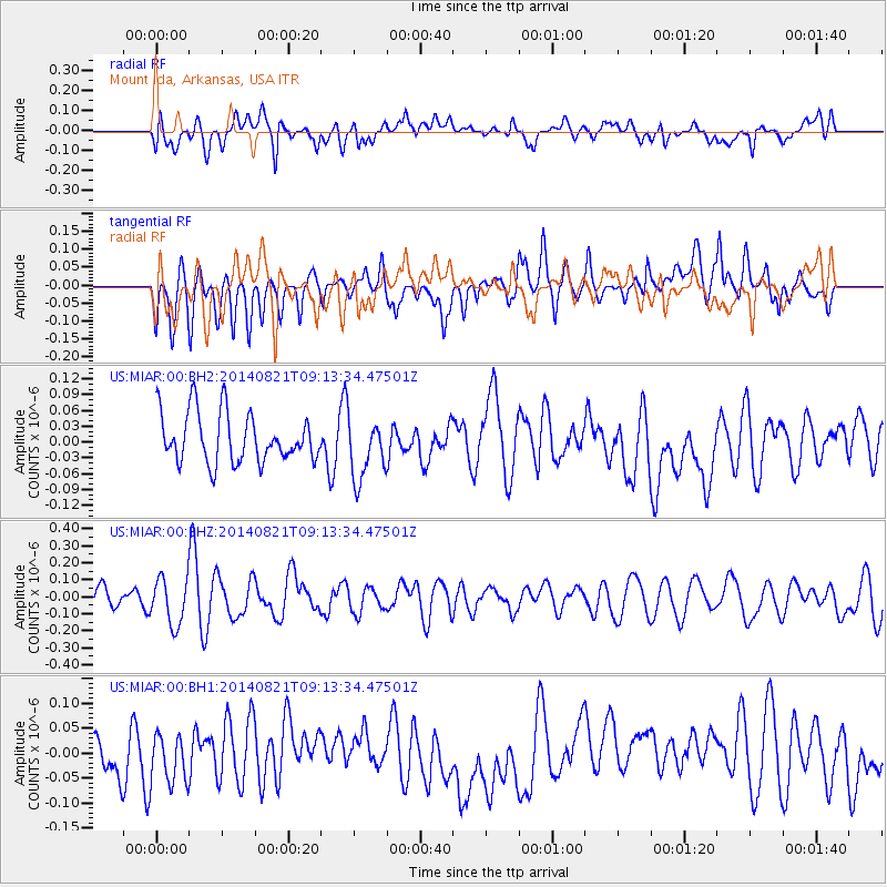
MIAR Mount Ida, Arkansas, USA - Earthquake Result Viewer
*The percent match for this event was below the threshold and hence no stack was calculated.
| Earthquake location: |
Tonga Islands Region |
| Earthquake latitude/longitude: |
-17.6/-172.9 |
| Earthquake time(UTC): |
2014/08/21 (233) 09:01:00 GMT |
| Earthquake Depth: |
10 km |
| Earthquake Magnitude: |
5.3 MW, 5.1 mb |
| Earthquake Catalog/Contributor: |
ISC/ISC |
|
| Network: |
US United States National Seismic Network |
| Station: |
MIAR Mount Ida, Arkansas, USA |
| Lat/Lon: |
34.55 N/93.58 W |
| Elevation: |
207 m |
|
| Distance: |
91.3 deg |
| Az: |
54.224 deg |
| Baz: |
249.659 deg |
| Ray Param: |
$rayparam |
*The percent match for this event was below the threshold and hence was not used in the summary stack. |
|
| Radial Match: |
46.261444 % |
| Radial Bump: |
400 |
| Transverse Match: |
45.365673 % |
| Transverse Bump: |
400 |
| SOD ConfigId: |
3390531 |
| Insert Time: |
2019-04-13 12:54:19.292 +0000 |
| GWidth: |
2.5 |
| Max Bumps: |
400 |
| Tol: |
0.001 |
|
Signal To Noise
| Channel | StoN | STA | LTA |
| US:MIAR:00:BHZ:20140821T09:13:34.47501Z | 2.2471418 | 1.3643707E-7 | 6.071583E-8 |
| US:MIAR:00:BH1:20140821T09:13:34.47501Z | 0.9776643 | 4.8689788E-8 | 4.9802154E-8 |
| US:MIAR:00:BH2:20140821T09:13:34.47501Z | 1.2382015 | 5.792616E-8 | 4.67825E-8 |
| Arrivals |
| Ps | |
| PpPs | |
| PsPs/PpSs | |


