
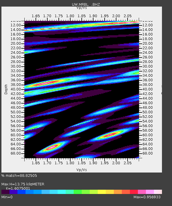
MRBL Marblemount, WA, USA - Earthquake Result Viewer
| ||||||||||||||||||
| ||||||||||||||||||
| ||||||||||||||||||
|
Signal To Noise
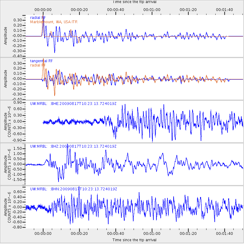
| Channel | StoN | STA | LTA |
| UW:MRBL: :BHZ:20090817T10:23:13.724019Z | 7.0929213 | 3.4500286E-7 | 4.8640448E-8 |
| UW:MRBL: :BHN:20090817T10:23:13.724019Z | 1.5145259 | 9.08906E-8 | 6.0012574E-8 |
| UW:MRBL: :BHE:20090817T10:23:13.724019Z | 1.5711905 | 9.7867044E-8 | 6.2288464E-8 |
| Arrivals | |
| Ps | 1.3 SECOND |
| PpPs | 5.3 SECOND |
| PsPs/PpSs | 6.6 SECOND |

