You are here: Home > Network List > TA - USArray Transportable Network (new EarthScope stations) Stations List
> Station A04D Lummi Island, WA, USA > Earthquake Result Viewer
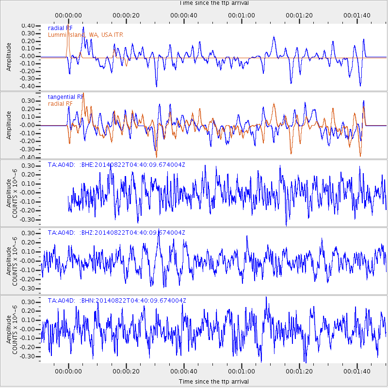
A04D Lummi Island, WA, USA - Earthquake Result Viewer
*The percent match for this event was below the threshold and hence no stack was calculated.
| Earthquake location: |
Aegean Sea |
| Earthquake latitude/longitude: |
39.5/23.3 |
| Earthquake time(UTC): |
2014/08/22 (234) 04:27:55 GMT |
| Earthquake Depth: |
10 km |
| Earthquake Magnitude: |
5.2 MW |
| Earthquake Catalog/Contributor: |
ISC/ISC |
|
| Network: |
TA USArray Transportable Network (new EarthScope stations) |
| Station: |
A04D Lummi Island, WA, USA |
| Lat/Lon: |
48.72 N/122.71 W |
| Elevation: |
13 m |
|
| Distance: |
87.2 deg |
| Az: |
338.254 deg |
| Baz: |
25.653 deg |
| Ray Param: |
$rayparam |
*The percent match for this event was below the threshold and hence was not used in the summary stack. |
|
| Radial Match: |
49.977814 % |
| Radial Bump: |
400 |
| Transverse Match: |
50.858505 % |
| Transverse Bump: |
400 |
| SOD ConfigId: |
3390531 |
| Insert Time: |
2019-04-13 13:04:56.250 +0000 |
| GWidth: |
2.5 |
| Max Bumps: |
400 |
| Tol: |
0.001 |
|
Signal To Noise
| Channel | StoN | STA | LTA |
| TA:A04D: :BHZ:20140822T04:40:09.674004Z | 0.7881328 | 7.762473E-8 | 9.8491945E-8 |
| TA:A04D: :BHN:20140822T04:40:09.674004Z | 0.97513306 | 1.0805257E-7 | 1.10808024E-7 |
| TA:A04D: :BHE:20140822T04:40:09.674004Z | 0.87232804 | 1.08526265E-7 | 1.2440992E-7 |
| Arrivals |
| Ps | |
| PpPs | |
| PsPs/PpSs | |


