You are here: Home > Network List > TA - USArray Transportable Network (new EarthScope stations) Stations List
> Station O48A Farmland, IN, USA > Earthquake Result Viewer
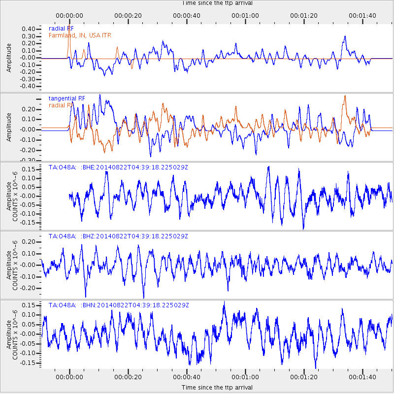
O48A Farmland, IN, USA - Earthquake Result Viewer
*The percent match for this event was below the threshold and hence no stack was calculated.
| Earthquake location: |
Aegean Sea |
| Earthquake latitude/longitude: |
39.5/23.3 |
| Earthquake time(UTC): |
2014/08/22 (234) 04:27:55 GMT |
| Earthquake Depth: |
10 km |
| Earthquake Magnitude: |
5.2 MW |
| Earthquake Catalog/Contributor: |
ISC/ISC |
|
| Network: |
TA USArray Transportable Network (new EarthScope stations) |
| Station: |
O48A Farmland, IN, USA |
| Lat/Lon: |
40.26 N/85.16 W |
| Elevation: |
300 m |
|
| Distance: |
77.3 deg |
| Az: |
311.921 deg |
| Baz: |
48.796 deg |
| Ray Param: |
$rayparam |
*The percent match for this event was below the threshold and hence was not used in the summary stack. |
|
| Radial Match: |
47.802235 % |
| Radial Bump: |
400 |
| Transverse Match: |
41.49986 % |
| Transverse Bump: |
400 |
| SOD ConfigId: |
3390531 |
| Insert Time: |
2019-04-13 13:05:30.615 +0000 |
| GWidth: |
2.5 |
| Max Bumps: |
400 |
| Tol: |
0.001 |
|
Signal To Noise
| Channel | StoN | STA | LTA |
| TA:O48A: :BHZ:20140822T04:39:18.225029Z | 1.1878442 | 7.540597E-8 | 6.348137E-8 |
| TA:O48A: :BHN:20140822T04:39:18.225029Z | 0.97112095 | 6.385595E-8 | 6.575489E-8 |
| TA:O48A: :BHE:20140822T04:39:18.225029Z | 0.87422746 | 4.979369E-8 | 5.695736E-8 |
| Arrivals |
| Ps | |
| PpPs | |
| PsPs/PpSs | |


