You are here: Home > Network List > UW - Pacific Northwest Regional Seismic Network Stations List
> Station MRBL Marblemount, WA, USA > Earthquake Result Viewer
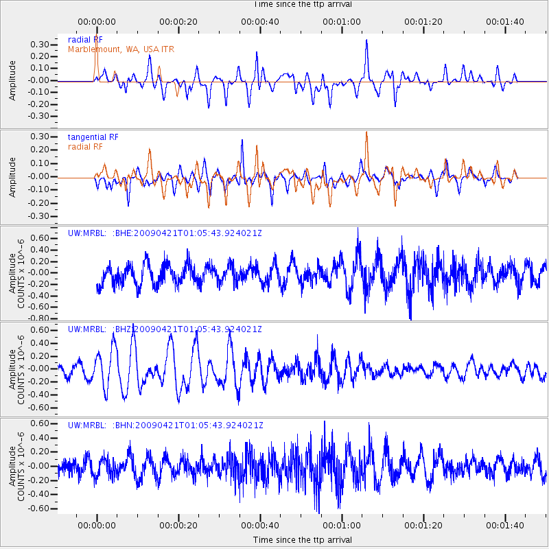
MRBL Marblemount, WA, USA - Earthquake Result Viewer
*The percent match for this event was below the threshold and hence no stack was calculated.
| Earthquake location: |
Vanuatu Islands |
| Earthquake latitude/longitude: |
-19.8/169.9 |
| Earthquake time(UTC): |
2009/04/21 (111) 00:53:13 GMT |
| Earthquake Depth: |
36 km |
| Earthquake Magnitude: |
5.6 MB, 5.3 MS, 5.8 MW, 5.6 MW |
| Earthquake Catalog/Contributor: |
WHDF/NEIC |
|
| Network: |
UW Pacific Northwest Regional Seismic Network |
| Station: |
MRBL Marblemount, WA, USA |
| Lat/Lon: |
48.52 N/121.48 W |
| Elevation: |
75 m |
|
| Distance: |
91.3 deg |
| Az: |
38.25 deg |
| Baz: |
241.273 deg |
| Ray Param: |
$rayparam |
*The percent match for this event was below the threshold and hence was not used in the summary stack. |
|
| Radial Match: |
68.180176 % |
| Radial Bump: |
400 |
| Transverse Match: |
77.17499 % |
| Transverse Bump: |
400 |
| SOD ConfigId: |
2760 |
| Insert Time: |
2010-02-27 04:52:18.960 +0000 |
| GWidth: |
2.5 |
| Max Bumps: |
400 |
| Tol: |
0.001 |
|
Signal To Noise
| Channel | StoN | STA | LTA |
| UW:MRBL: :BHZ:20090421T01:05:43.924021Z | 2.5353675 | 3.0801849E-7 | 1.214887E-7 |
| UW:MRBL: :BHN:20090421T01:05:43.924021Z | 1.235575 | 1.2078027E-7 | 9.775228E-8 |
| UW:MRBL: :BHE:20090421T01:05:43.924021Z | 0.8263173 | 1.4260364E-7 | 1.7257733E-7 |
| Arrivals |
| Ps | |
| PpPs | |
| PsPs/PpSs | |


