You are here: Home > Network List > UW - Pacific Northwest Regional Seismic Network Stations List
> Station MRBL Marblemount, WA, USA > Earthquake Result Viewer
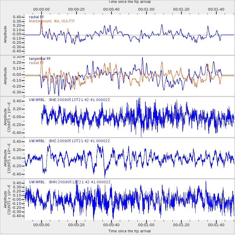
MRBL Marblemount, WA, USA - Earthquake Result Viewer
*The percent match for this event was below the threshold and hence no stack was calculated.
| Earthquake location: |
Tonga Islands |
| Earthquake latitude/longitude: |
-15.8/-173.5 |
| Earthquake time(UTC): |
2009/05/13 (133) 21:31:17 GMT |
| Earthquake Depth: |
85 km |
| Earthquake Magnitude: |
5.8 MW, 5.3 MB, 5.8 MW |
| Earthquake Catalog/Contributor: |
WHDF/NEIC |
|
| Network: |
UW Pacific Northwest Regional Seismic Network |
| Station: |
MRBL Marblemount, WA, USA |
| Lat/Lon: |
48.52 N/121.48 W |
| Elevation: |
75 m |
|
| Distance: |
78.9 deg |
| Az: |
32.274 deg |
| Baz: |
230.655 deg |
| Ray Param: |
$rayparam |
*The percent match for this event was below the threshold and hence was not used in the summary stack. |
|
| Radial Match: |
52.06693 % |
| Radial Bump: |
400 |
| Transverse Match: |
47.60244 % |
| Transverse Bump: |
400 |
| SOD ConfigId: |
2760 |
| Insert Time: |
2010-02-27 04:52:23.394 +0000 |
| GWidth: |
2.5 |
| Max Bumps: |
400 |
| Tol: |
0.001 |
|
Signal To Noise
| Channel | StoN | STA | LTA |
| UW:MRBL: :BHZ:20090513T21:42:41.00002Z | 2.2016938 | 2.2462096E-7 | 1.0202189E-7 |
| UW:MRBL: :BHN:20090513T21:42:41.00002Z | 0.85583746 | 1.1943497E-7 | 1.3955334E-7 |
| UW:MRBL: :BHE:20090513T21:42:41.00002Z | 1.0476062 | 1.261685E-7 | 1.2043505E-7 |
| Arrivals |
| Ps | |
| PpPs | |
| PsPs/PpSs | |


