You are here: Home > Network List > UW - Pacific Northwest Regional Seismic Network Stations List
> Station MRBL Marblemount, WA, USA > Earthquake Result Viewer
MRBL Marblemount, WA, USA - Earthquake Result Viewer
*The percent match for this event was below the threshold and hence no stack was calculated.
| Earthquake location: |
Southwestern Ryukyu Isl., Japan |
| Earthquake latitude/longitude: |
23.5/123.5 |
| Earthquake time(UTC): |
2009/08/18 (230) 13:17:35 GMT |
| Earthquake Depth: |
5.7 km |
| Earthquake Magnitude: |
5.6 MB, 5.2 MS |
| Earthquake Catalog/Contributor: |
WHDF/NEIC |
|
| Network: |
UW Pacific Northwest Regional Seismic Network |
| Station: |
MRBL Marblemount, WA, USA |
| Lat/Lon: |
48.52 N/121.48 W |
| Elevation: |
75 m |
|
| Distance: |
87.8 deg |
| Az: |
37.087 deg |
| Baz: |
303.636 deg |
| Ray Param: |
$rayparam |
*The percent match for this event was below the threshold and hence was not used in the summary stack. |
|
| Radial Match: |
69.19789 % |
| Radial Bump: |
400 |
| Transverse Match: |
63.220856 % |
| Transverse Bump: |
400 |
| SOD ConfigId: |
2622 |
| Insert Time: |
2010-02-27 04:52:29.703 +0000 |
| GWidth: |
2.5 |
| Max Bumps: |
400 |
| Tol: |
0.001 |
|
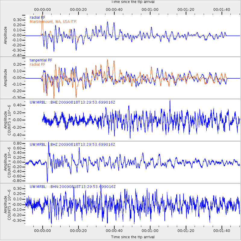
Signal To Noise
| Channel | StoN | STA | LTA |
| UW:MRBL: :BHZ:20090818T13:29:53.699016Z | 4.154269 | 3.195146E-7 | 7.691236E-8 |
| UW:MRBL: :BHN:20090818T13:29:53.699016Z | 1.1688051 | 1.0700919E-7 | 9.1554355E-8 |
| UW:MRBL: :BHE:20090818T13:29:53.699016Z | 1.0867118 | 9.583023E-8 | 8.818367E-8 |
| Arrivals |
| Ps | |
| PpPs | |
| PsPs/PpSs | |


