You are here: Home > Network List > TA - USArray Transportable Network (new EarthScope stations) Stations List
> Station M61A Granite Springs, NY, USA > Earthquake Result Viewer
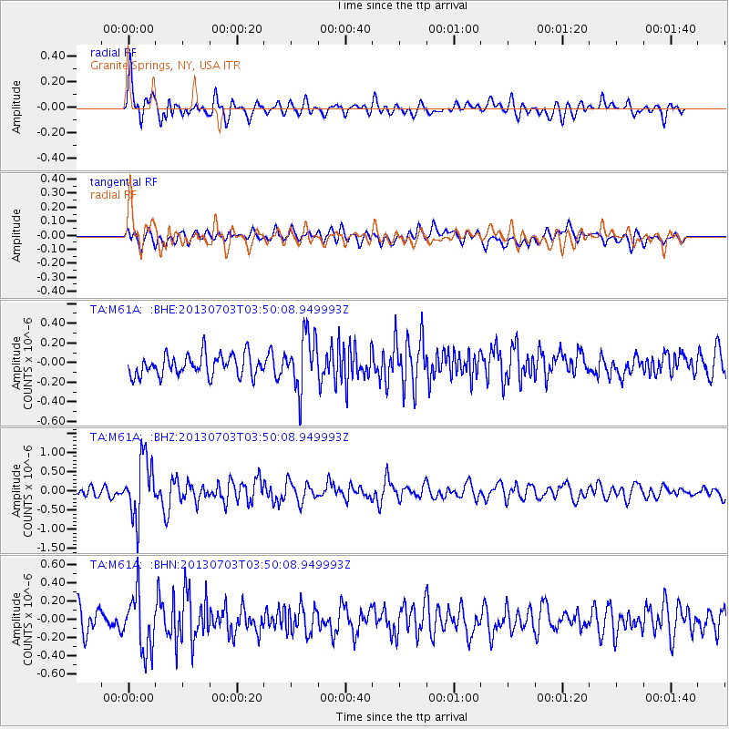
M61A Granite Springs, NY, USA - Earthquake Result Viewer
*The percent match for this event was below the threshold and hence no stack was calculated.
| Earthquake location: |
Fox Islands, Aleutian Islands |
| Earthquake latitude/longitude: |
51.6/-167.0 |
| Earthquake time(UTC): |
2013/07/03 (184) 03:40:27 GMT |
| Earthquake Depth: |
5.1 km |
| Earthquake Magnitude: |
5.8 MW, 5.7 MW, 5.9 MB |
| Earthquake Catalog/Contributor: |
NEIC PDE/NEIC PDE-W |
|
| Network: |
TA USArray Transportable Network (new EarthScope stations) |
| Station: |
M61A Granite Springs, NY, USA |
| Lat/Lon: |
41.31 N/73.77 W |
| Elevation: |
190 m |
|
| Distance: |
60.8 deg |
| Az: |
59.479 deg |
| Baz: |
314.526 deg |
| Ray Param: |
$rayparam |
*The percent match for this event was below the threshold and hence was not used in the summary stack. |
|
| Radial Match: |
66.03958 % |
| Radial Bump: |
400 |
| Transverse Match: |
58.00219 % |
| Transverse Bump: |
400 |
| SOD ConfigId: |
512894 |
| Insert Time: |
2013-09-15 13:41:14.764 +0000 |
| GWidth: |
2.5 |
| Max Bumps: |
400 |
| Tol: |
0.001 |
|
Signal To Noise
| Channel | StoN | STA | LTA |
| TA:M61A: :BHZ:20130703T03:50:08.949993Z | 6.1691794 | 7.667442E-7 | 1.2428625E-7 |
| TA:M61A: :BHN:20130703T03:50:08.949993Z | 2.9076715 | 3.1523672E-7 | 1.0841553E-7 |
| TA:M61A: :BHE:20130703T03:50:08.949993Z | 2.5903525 | 2.7957265E-7 | 1.0792842E-7 |
| Arrivals |
| Ps | |
| PpPs | |
| PsPs/PpSs | |


