You are here: Home > Network List > UW - Pacific Northwest Regional Seismic Network Stations List
> Station MRBL Marblemount, WA, USA > Earthquake Result Viewer
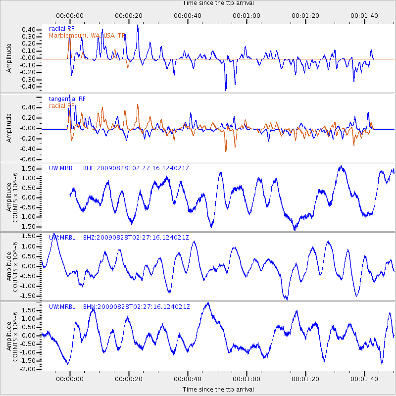
MRBL Marblemount, WA, USA - Earthquake Result Viewer
*The percent match for this event was below the threshold and hence no stack was calculated.
| Earthquake location: |
Qinghai, China |
| Earthquake latitude/longitude: |
37.6/95.7 |
| Earthquake time(UTC): |
2009/08/28 (240) 02:14:56 GMT |
| Earthquake Depth: |
4.0 km |
| Earthquake Magnitude: |
5.6 MB |
| Earthquake Catalog/Contributor: |
WHDF/NEIC |
|
| Network: |
UW Pacific Northwest Regional Seismic Network |
| Station: |
MRBL Marblemount, WA, USA |
| Lat/Lon: |
48.52 N/121.48 W |
| Elevation: |
75 m |
|
| Distance: |
88.1 deg |
| Az: |
23.713 deg |
| Baz: |
331.307 deg |
| Ray Param: |
$rayparam |
*The percent match for this event was below the threshold and hence was not used in the summary stack. |
|
| Radial Match: |
48.680817 % |
| Radial Bump: |
387 |
| Transverse Match: |
68.68323 % |
| Transverse Bump: |
359 |
| SOD ConfigId: |
2622 |
| Insert Time: |
2010-02-27 04:52:36.006 +0000 |
| GWidth: |
2.5 |
| Max Bumps: |
400 |
| Tol: |
0.001 |
|
Signal To Noise
| Channel | StoN | STA | LTA |
| UW:MRBL: :BHZ:20090828T02:27:16.124021Z | 1.1544433 | 6.102106E-7 | 5.2857564E-7 |
| UW:MRBL: :BHN:20090828T02:27:16.124021Z | 2.6479003 | 8.8521733E-7 | 3.3430916E-7 |
| UW:MRBL: :BHE:20090828T02:27:16.124021Z | 1.9104398 | 9.326146E-7 | 4.8816753E-7 |
| Arrivals |
| Ps | |
| PpPs | |
| PsPs/PpSs | |


