You are here: Home > Network List > UW - Pacific Northwest Regional Seismic Network Stations List
> Station MRBL Marblemount, WA, USA > Earthquake Result Viewer
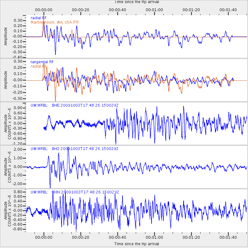
MRBL Marblemount, WA, USA - Earthquake Result Viewer
*The percent match for this event was below the threshold and hence no stack was calculated.
| Earthquake location: |
Taiwan |
| Earthquake latitude/longitude: |
23.6/121.5 |
| Earthquake time(UTC): |
2009/10/03 (276) 17:36:06 GMT |
| Earthquake Depth: |
28 km |
| Earthquake Magnitude: |
6.0 MB, 5.7 MS, 6.0 MW, 6.1 MW |
| Earthquake Catalog/Contributor: |
WHDF/NEIC |
|
| Network: |
UW Pacific Northwest Regional Seismic Network |
| Station: |
MRBL Marblemount, WA, USA |
| Lat/Lon: |
48.52 N/121.48 W |
| Elevation: |
75 m |
|
| Distance: |
88.8 deg |
| Az: |
36.313 deg |
| Baz: |
305.226 deg |
| Ray Param: |
$rayparam |
*The percent match for this event was below the threshold and hence was not used in the summary stack. |
|
| Radial Match: |
79.847336 % |
| Radial Bump: |
400 |
| Transverse Match: |
66.51475 % |
| Transverse Bump: |
400 |
| SOD ConfigId: |
2622 |
| Insert Time: |
2010-02-27 04:52:46.565 +0000 |
| GWidth: |
2.5 |
| Max Bumps: |
400 |
| Tol: |
0.001 |
|
Signal To Noise
| Channel | StoN | STA | LTA |
| UW:MRBL: :BHZ:20091003T17:48:26.150029Z | 7.472408 | 7.44081E-7 | 9.9577136E-8 |
| UW:MRBL: :BHN:20091003T17:48:26.150029Z | 1.2871475 | 1.8201762E-7 | 1.4141163E-7 |
| UW:MRBL: :BHE:20091003T17:48:26.150029Z | 1.404381 | 2.3015984E-7 | 1.6388704E-7 |
| Arrivals |
| Ps | |
| PpPs | |
| PsPs/PpSs | |


