You are here: Home > Network List > UW - Pacific Northwest Regional Seismic Network Stations List
> Station MRBL Marblemount, WA, USA > Earthquake Result Viewer
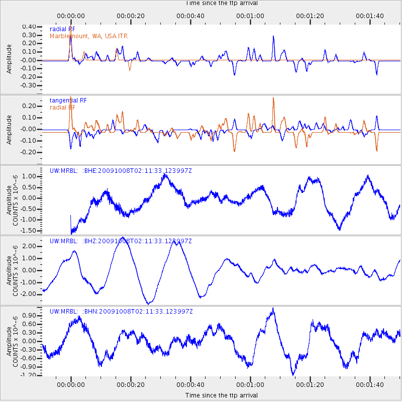
MRBL Marblemount, WA, USA - Earthquake Result Viewer
*The percent match for this event was below the threshold and hence no stack was calculated.
| Earthquake location: |
Santa Cruz Islands |
| Earthquake latitude/longitude: |
-11.9/166.0 |
| Earthquake time(UTC): |
2009/10/08 (281) 01:59:19 GMT |
| Earthquake Depth: |
35 km |
| Earthquake Magnitude: |
5.9 MB |
| Earthquake Catalog/Contributor: |
WHDF/NEIC |
|
| Network: |
UW Pacific Northwest Regional Seismic Network |
| Station: |
MRBL Marblemount, WA, USA |
| Lat/Lon: |
48.52 N/121.48 W |
| Elevation: |
75 m |
|
| Distance: |
87.6 deg |
| Az: |
39.409 deg |
| Baz: |
249.164 deg |
| Ray Param: |
$rayparam |
*The percent match for this event was below the threshold and hence was not used in the summary stack. |
|
| Radial Match: |
68.339615 % |
| Radial Bump: |
400 |
| Transverse Match: |
73.325356 % |
| Transverse Bump: |
400 |
| SOD ConfigId: |
2622 |
| Insert Time: |
2010-02-27 04:52:50.659 +0000 |
| GWidth: |
2.5 |
| Max Bumps: |
400 |
| Tol: |
0.001 |
|
Signal To Noise
| Channel | StoN | STA | LTA |
| UW:MRBL: :BHZ:20091008T02:11:33.123997Z | 1.0720073 | 1.2724507E-6 | 1.1869795E-6 |
| UW:MRBL: :BHN:20091008T02:11:33.123997Z | 1.7808061 | 9.394256E-7 | 5.275283E-7 |
| UW:MRBL: :BHE:20091008T02:11:33.123997Z | 2.7717671 | 1.298827E-6 | 4.6859168E-7 |
| Arrivals |
| Ps | |
| PpPs | |
| PsPs/PpSs | |


