You are here: Home > Network List > TA - USArray Transportable Network (new EarthScope stations) Stations List
> Station T60A Surry, VA, USA > Earthquake Result Viewer
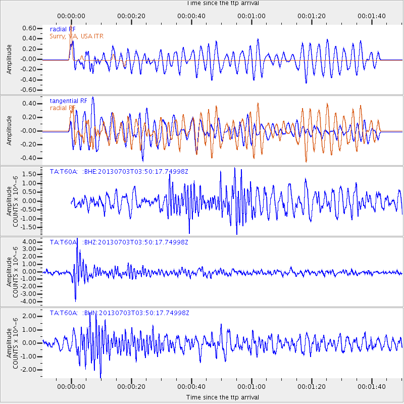
T60A Surry, VA, USA - Earthquake Result Viewer
*The percent match for this event was below the threshold and hence no stack was calculated.
| Earthquake location: |
Fox Islands, Aleutian Islands |
| Earthquake latitude/longitude: |
51.6/-167.0 |
| Earthquake time(UTC): |
2013/07/03 (184) 03:40:27 GMT |
| Earthquake Depth: |
5.1 km |
| Earthquake Magnitude: |
5.8 MW, 5.7 MW, 5.9 MB |
| Earthquake Catalog/Contributor: |
NEIC PDE/NEIC PDE-W |
|
| Network: |
TA USArray Transportable Network (new EarthScope stations) |
| Station: |
T60A Surry, VA, USA |
| Lat/Lon: |
37.14 N/76.73 W |
| Elevation: |
11 m |
|
| Distance: |
62.1 deg |
| Az: |
64.691 deg |
| Baz: |
315.146 deg |
| Ray Param: |
$rayparam |
*The percent match for this event was below the threshold and hence was not used in the summary stack. |
|
| Radial Match: |
61.292233 % |
| Radial Bump: |
400 |
| Transverse Match: |
39.644657 % |
| Transverse Bump: |
400 |
| SOD ConfigId: |
512894 |
| Insert Time: |
2013-09-15 13:47:45.790 +0000 |
| GWidth: |
2.5 |
| Max Bumps: |
400 |
| Tol: |
0.001 |
|
Signal To Noise
| Channel | StoN | STA | LTA |
| TA:T60A: :BHZ:20130703T03:50:17.74998Z | 11.358755 | 1.6435924E-6 | 1.4469829E-7 |
| TA:T60A: :BHN:20130703T03:50:17.74998Z | 1.7966864 | 8.013133E-7 | 4.4599508E-7 |
| TA:T60A: :BHE:20130703T03:50:17.74998Z | 1.7206024 | 5.9452503E-7 | 3.4553307E-7 |
| Arrivals |
| Ps | |
| PpPs | |
| PsPs/PpSs | |


