You are here: Home > Network List > TA - USArray Transportable Network (new EarthScope stations) Stations List
> Station G59A Clarenceville, QC, USA > Earthquake Result Viewer
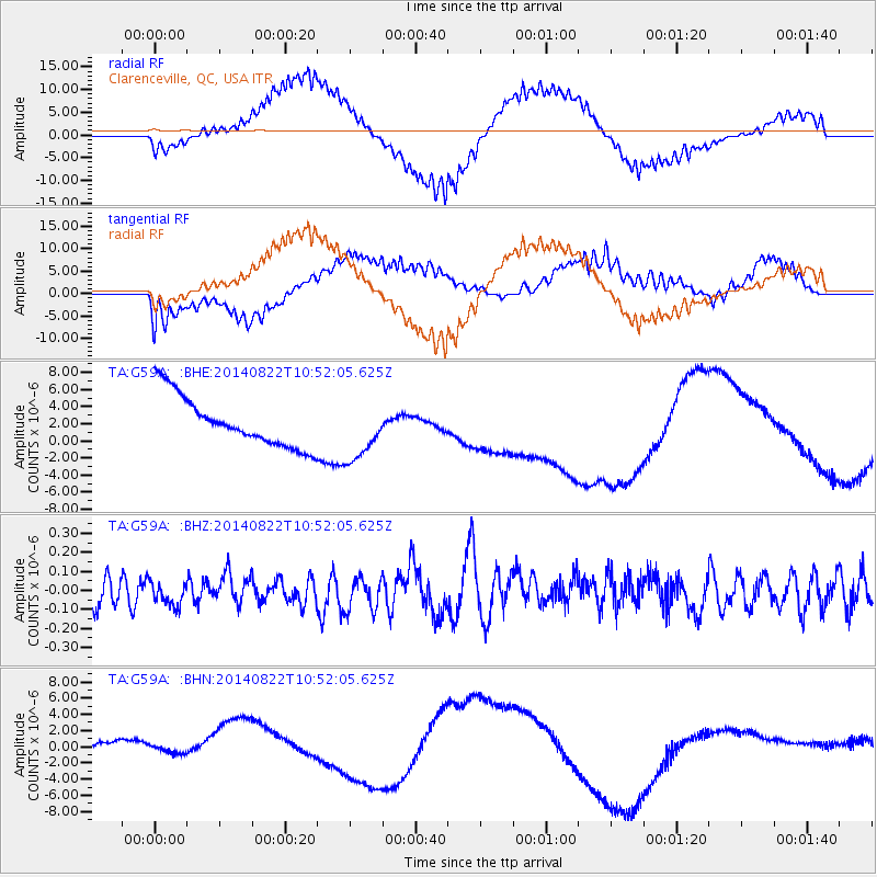
G59A Clarenceville, QC, USA - Earthquake Result Viewer
*The percent match for this event was below the threshold and hence no stack was calculated.
| Earthquake location: |
Iran-Iraq Border Region |
| Earthquake latitude/longitude: |
32.7/47.6 |
| Earthquake time(UTC): |
2014/08/22 (234) 10:40:00 GMT |
| Earthquake Depth: |
26 km |
| Earthquake Magnitude: |
4.9 MW, 5.0 mb |
| Earthquake Catalog/Contributor: |
ISC/ISC |
|
| Network: |
TA USArray Transportable Network (new EarthScope stations) |
| Station: |
G59A Clarenceville, QC, USA |
| Lat/Lon: |
45.08 N/73.18 W |
| Elevation: |
36 m |
|
| Distance: |
85.8 deg |
| Az: |
322.401 deg |
| Baz: |
46.572 deg |
| Ray Param: |
$rayparam |
*The percent match for this event was below the threshold and hence was not used in the summary stack. |
|
| Radial Match: |
56.353256 % |
| Radial Bump: |
400 |
| Transverse Match: |
41.989594 % |
| Transverse Bump: |
400 |
| SOD ConfigId: |
3390531 |
| Insert Time: |
2019-04-13 13:13:02.576 +0000 |
| GWidth: |
2.5 |
| Max Bumps: |
400 |
| Tol: |
0.001 |
|
Signal To Noise
| Channel | StoN | STA | LTA |
| TA:G59A: :BHZ:20140822T10:52:05.625Z | 0.6445262 | 6.277282E-8 | 9.7393745E-8 |
| TA:G59A: :BHN:20140822T10:52:05.625Z | 0.8319998 | 2.7156464E-6 | 3.263999E-6 |
| TA:G59A: :BHE:20140822T10:52:05.625Z | 1.1704574 | 3.4205489E-6 | 2.9224036E-6 |
| Arrivals |
| Ps | |
| PpPs | |
| PsPs/PpSs | |


