You are here: Home > Network List > UW - Pacific Northwest Regional Seismic Network Stations List
> Station UMAT Pilot Rock, OR, USA > Earthquake Result Viewer
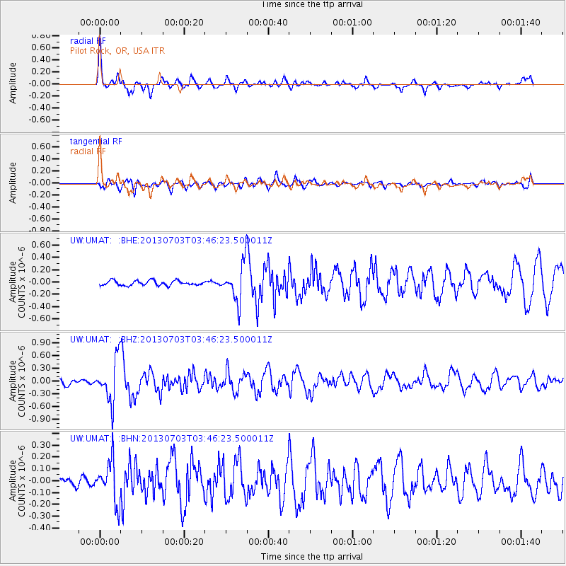
UMAT Pilot Rock, OR, USA - Earthquake Result Viewer
*The percent match for this event was below the threshold and hence no stack was calculated.
| Earthquake location: |
Fox Islands, Aleutian Islands |
| Earthquake latitude/longitude: |
51.6/-167.0 |
| Earthquake time(UTC): |
2013/07/03 (184) 03:40:27 GMT |
| Earthquake Depth: |
5.1 km |
| Earthquake Magnitude: |
5.8 MW, 5.7 MW, 5.9 MB |
| Earthquake Catalog/Contributor: |
NEIC PDE/NEIC PDE-W |
|
| Network: |
UW Pacific Northwest Regional Seismic Network |
| Station: |
UMAT Pilot Rock, OR, USA |
| Lat/Lon: |
45.29 N/118.96 W |
| Elevation: |
1318 m |
|
| Distance: |
32.0 deg |
| Az: |
82.115 deg |
| Baz: |
298.97 deg |
| Ray Param: |
$rayparam |
*The percent match for this event was below the threshold and hence was not used in the summary stack. |
|
| Radial Match: |
73.00946 % |
| Radial Bump: |
384 |
| Transverse Match: |
60.694775 % |
| Transverse Bump: |
400 |
| SOD ConfigId: |
512894 |
| Insert Time: |
2013-09-15 13:57:50.596 +0000 |
| GWidth: |
2.5 |
| Max Bumps: |
400 |
| Tol: |
0.001 |
|
Signal To Noise
| Channel | StoN | STA | LTA |
| UW:UMAT: :BHZ:20130703T03:46:23.500011Z | 7.7730274 | 5.186951E-7 | 6.6730124E-8 |
| UW:UMAT: :BHN:20130703T03:46:23.500011Z | 3.6266513 | 1.7959998E-7 | 4.9522267E-8 |
| UW:UMAT: :BHE:20130703T03:46:23.500011Z | 8.102732 | 3.119894E-7 | 3.8504222E-8 |
| Arrivals |
| Ps | |
| PpPs | |
| PsPs/PpSs | |


