You are here: Home > Network List > TA - USArray Transportable Network (new EarthScope stations) Stations List
> Station V60A Jim Taylor Road, Stokes, NC, USA > Earthquake Result Viewer
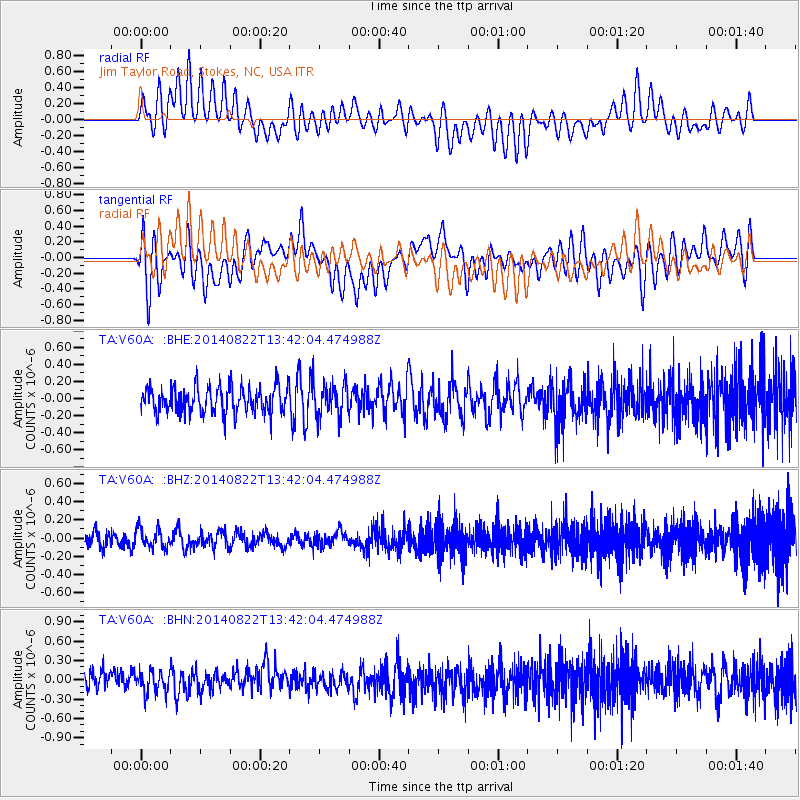
V60A Jim Taylor Road, Stokes, NC, USA - Earthquake Result Viewer
*The percent match for this event was below the threshold and hence no stack was calculated.
| Earthquake location: |
Iran-Iraq Border Region |
| Earthquake latitude/longitude: |
32.7/47.7 |
| Earthquake time(UTC): |
2014/08/22 (234) 13:29:18 GMT |
| Earthquake Depth: |
33 km |
| Earthquake Magnitude: |
5.0 mb |
| Earthquake Catalog/Contributor: |
ISC/ISC |
|
| Network: |
TA USArray Transportable Network (new EarthScope stations) |
| Station: |
V60A Jim Taylor Road, Stokes, NC, USA |
| Lat/Lon: |
35.76 N/77.26 W |
| Elevation: |
8.0 m |
|
| Distance: |
94.6 deg |
| Az: |
318.039 deg |
| Baz: |
43.912 deg |
| Ray Param: |
$rayparam |
*The percent match for this event was below the threshold and hence was not used in the summary stack. |
|
| Radial Match: |
48.12246 % |
| Radial Bump: |
400 |
| Transverse Match: |
50.883236 % |
| Transverse Bump: |
400 |
| SOD ConfigId: |
3390531 |
| Insert Time: |
2019-04-13 13:19:29.306 +0000 |
| GWidth: |
2.5 |
| Max Bumps: |
400 |
| Tol: |
0.001 |
|
Signal To Noise
| Channel | StoN | STA | LTA |
| TA:V60A: :BHZ:20140822T13:42:04.474988Z | 1.173043 | 1.0619576E-7 | 9.053015E-8 |
| TA:V60A: :BHN:20140822T13:42:04.474988Z | 0.96031743 | 1.7078912E-7 | 1.7784652E-7 |
| TA:V60A: :BHE:20140822T13:42:04.474988Z | 1.259677 | 1.9676972E-7 | 1.5620648E-7 |
| Arrivals |
| Ps | |
| PpPs | |
| PsPs/PpSs | |


