You are here: Home > Network List > UU - University of Utah Regional Network Stations List
> Station KNB Kanab, UT, USA > Earthquake Result Viewer
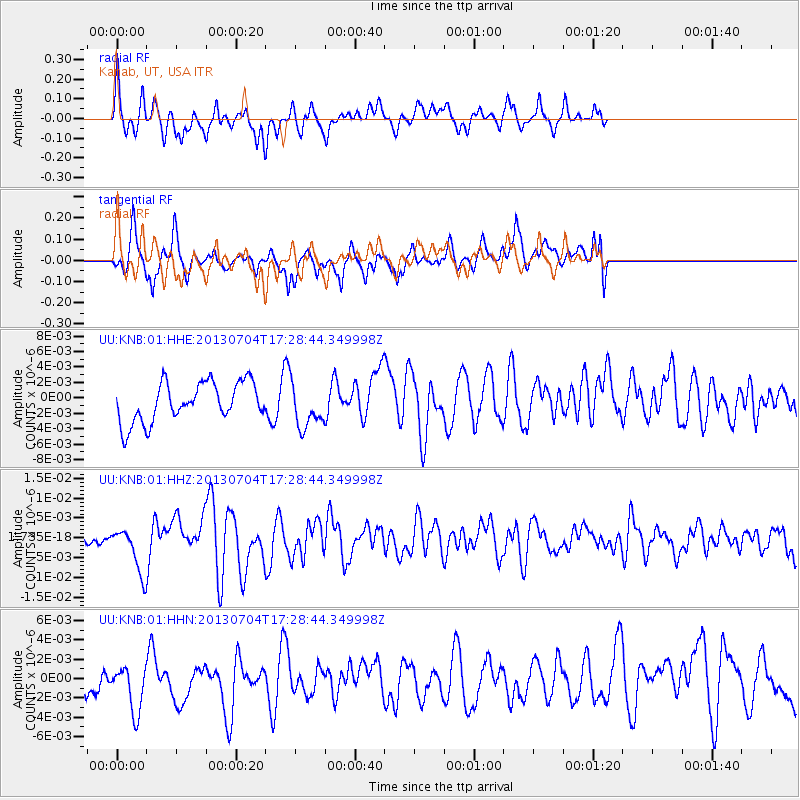
KNB Kanab, UT, USA - Earthquake Result Viewer
*The percent match for this event was below the threshold and hence no stack was calculated.
| Earthquake location: |
Solomon Islands |
| Earthquake latitude/longitude: |
-7.0/155.7 |
| Earthquake time(UTC): |
2013/07/04 (185) 17:15:54 GMT |
| Earthquake Depth: |
29 km |
| Earthquake Magnitude: |
6.1 MW, 5.7 MB, 6.0 MS, 6.1 MW |
| Earthquake Catalog/Contributor: |
NEIC PDE/NEIC PDE-W |
|
| Network: |
UU University of Utah Regional Network |
| Station: |
KNB Kanab, UT, USA |
| Lat/Lon: |
37.02 N/112.82 W |
| Elevation: |
1715 m |
|
| Distance: |
95.3 deg |
| Az: |
53.478 deg |
| Baz: |
265.264 deg |
| Ray Param: |
$rayparam |
*The percent match for this event was below the threshold and hence was not used in the summary stack. |
|
| Radial Match: |
64.89279 % |
| Radial Bump: |
371 |
| Transverse Match: |
49.249004 % |
| Transverse Bump: |
400 |
| SOD ConfigId: |
512894 |
| Insert Time: |
2013-09-15 14:32:42.729 +0000 |
| GWidth: |
2.5 |
| Max Bumps: |
400 |
| Tol: |
0.001 |
|
Signal To Noise
| Channel | StoN | STA | LTA |
| UU:KNB:01:HHZ:20130704T17:28:44.349998Z | 3.4961822 | 5.7495875E-9 | 1.6445331E-9 |
| UU:KNB:01:HHN:20130704T17:28:44.349998Z | 1.0717467 | 3.0515415E-9 | 2.8472598E-9 |
| UU:KNB:01:HHE:20130704T17:28:44.349998Z | 1.1266022 | 2.8730291E-9 | 2.5501719E-9 |
| Arrivals |
| Ps | |
| PpPs | |
| PsPs/PpSs | |


