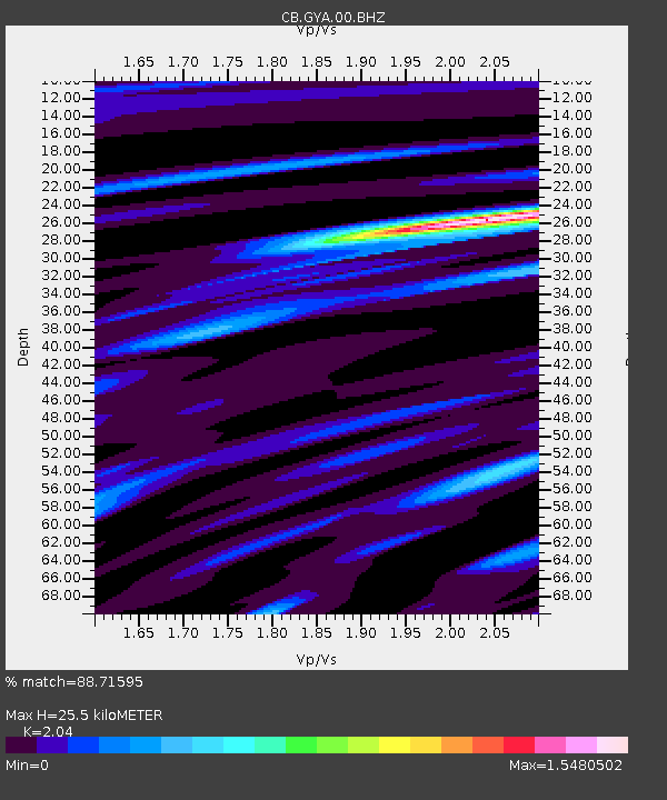
GYA Guiyang,Yunnan Province - Earthquake Result Viewer

Earthquake location: Southern Sumatra, Indonesia
Earthquake latitude/longitude: -3.3/100.6
Earthquake time(UTC): 2013/07/06 (187) 05:05:06 GMT
Earthquake Depth: 21 km
Earthquake Magnitude: 6.0 MW, 5.9 MB, 6.0 MW, 6.3 MS
Earthquake Catalog/Contributor: NEIC PDE/NEIC PDE-W
Network: CB China National Seismic Network
Station: GYA Guiyang,Yunnan Province
Lat/Lon: 26.46 N/106.66 E
Elevation: 1162 m
Distance: 30.1 deg
Az: 10.937 deg
Baz: 192.199 deg
Ray Param: 0.07939729
Estimated Moho Depth: 25.5 km
Estimated Crust Vp/Vs: 2.04
Assumed Crust Vp: 6.113 km/s
Estimated Crust Vs: 2.996 km/s
Estimated Crust Poisson's Ratio: 0.34
Radial Match: 88.71595 %
Radial Bump: 303
Transverse Match: 62.76792 %
Transverse Bump: 400
SOD ConfigId: 512894
Insert Time: 2013-09-15 14:37:17.037 +0000
GWidth: 2.5
Max Bumps: 400
Tol: 0.001

Signal To Noise

ChannelStoNSTALTA
CB:GYA:00:BHZ:20130706T05:10:44.38999Z26.059792.0009222E-67.678198E-8
CB:GYA:00:BHN:20130706T05:10:44.38999Z14.8957561.2278285E-68.242807E-8
CB:GYA:00:BHE:20130706T05:10:44.38999Z3.7522572.6308302E-77.0113266E-8
Arrivals
Ps4.6 SECOND
PpPs12 SECOND
PsPs/PpSs17 SECOND