TBLG Delisi, Georgia - Earthquake Result Viewer
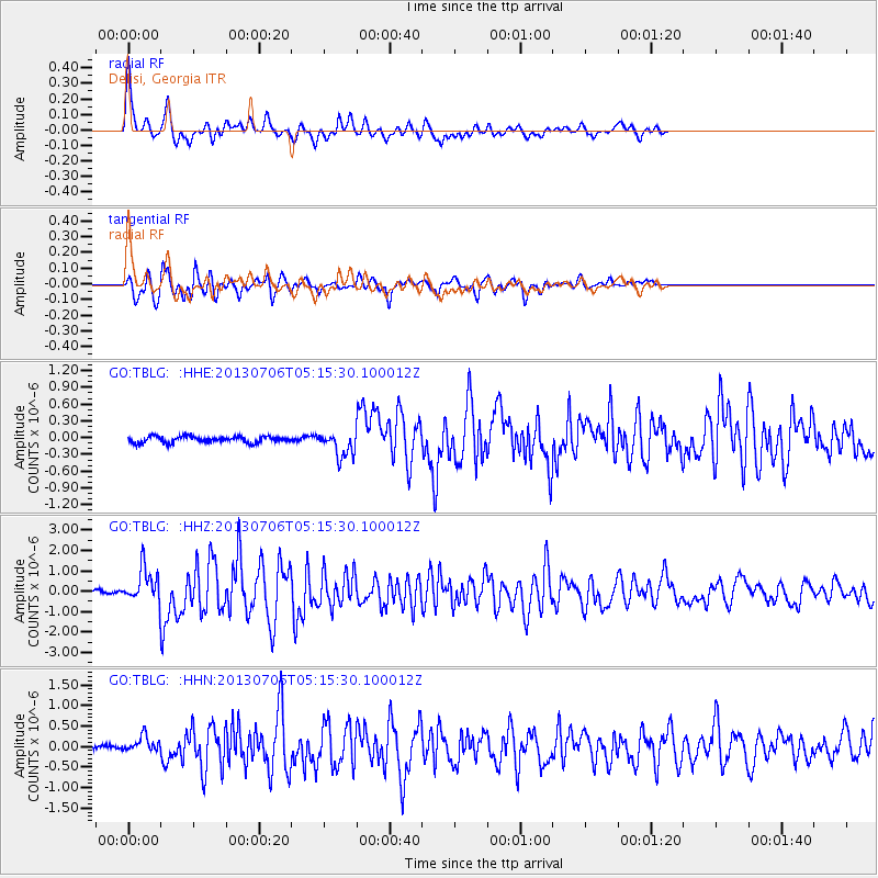
Earthquake location: Southern Sumatra, Indonesia
Earthquake latitude/longitude: -3.3/100.6
Earthquake time(UTC): 2013/07/06 (187) 05:05:06 GMT
Earthquake Depth: 21 km
Earthquake Magnitude: 6.0 MW, 5.9 MB, 6.0 MW, 6.3 MS
Earthquake Catalog/Contributor: NEIC PDE/NEIC PDE-W
Network: GO National Seismic Network of Georgia
Station: TBLG Delisi, Georgia
Lat/Lon: 41.73 N/44.74 E
Elevation: 510 m
Distance: 67.5 deg
Az: 317.923 deg
Baz: 116.637 deg
Ray Param: 0.056873545
Estimated Moho Depth: 61.0 km
Estimated Crust Vp/Vs: 1.62
Assumed Crust Vp: 6.291 km/s
Estimated Crust Vs: 3.889 km/s
Estimated Crust Poisson's Ratio: 0.19
Radial Match: 91.10472 %
Radial Bump: 400
Transverse Match: 90.13869 %
Transverse Bump: 400
SOD ConfigId: 512894
Insert Time: 2013-09-15 14:39:27.763 +0000
GWidth: 2.5
Max Bumps: 400
Tol: 0.001

Signal To Noise

ChannelStoNSTALTA
GO:TBLG: :HHZ:20130706T05:15:30.100012Z7.71352248.127844E-71.0537137E-7
GO:TBLG: :HHN:20130706T05:15:30.100012Z3.88491231.9089705E-74.9138063E-8
GO:TBLG: :HHE:20130706T05:15:30.100012Z4.054352.2456517E-75.5388703E-8
Arrivals
Ps6.2 SECOND
PpPs24 SECOND
PsPs/PpSs31 SECOND