NIL Nilore, Pakistan - Earthquake Result Viewer
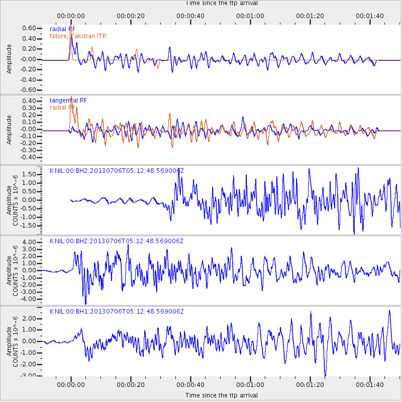
Earthquake location: Southern Sumatra, Indonesia
Earthquake latitude/longitude: -3.3/100.6
Earthquake time(UTC): 2013/07/06 (187) 05:05:06 GMT
Earthquake Depth: 21 km
Earthquake Magnitude: 6.0 MW, 5.9 MB, 6.0 MW, 6.3 MS
Earthquake Catalog/Contributor: NEIC PDE/NEIC PDE-W
Network: II Global Seismograph Network (GSN - IRIS/IDA)
Station: NIL Nilore, Pakistan
Lat/Lon: 33.65 N/73.27 E
Elevation: 629 m
Distance: 44.9 deg
Az: 327.16 deg
Baz: 139.528 deg
Ray Param: 0.07162847
Estimated Moho Depth: 14.75 km
Estimated Crust Vp/Vs: 1.82
Assumed Crust Vp: 6.242 km/s
Estimated Crust Vs: 3.434 km/s
Estimated Crust Poisson's Ratio: 0.28
Radial Match: 87.843185 %
Radial Bump: 400
Transverse Match: 76.54774 %
Transverse Bump: 400
SOD ConfigId: 512894
Insert Time: 2013-09-15 14:40:53.001 +0000
GWidth: 2.5
Max Bumps: 400
Tol: 0.001

Signal To Noise

ChannelStoNSTALTA
II:NIL:00:BHZ:20130706T05:12:48.569006Z24.3179871.7132387E-67.04515E-8
II:NIL:00:BH1:20130706T05:12:48.569006Z6.11965275.289431E-78.643351E-8
II:NIL:00:BH2:20130706T05:12:48.569006Z5.3928774.4973112E-78.339354E-8
Arrivals
Ps2.0 SECOND
PpPs6.3 SECOND
PsPs/PpSs8.3 SECOND