You are here: Home > Network List > IU - Global Seismograph Network (GSN - IRIS/USGS) Stations List
> Station HNR Honiara, Solomon Islands > Earthquake Result Viewer
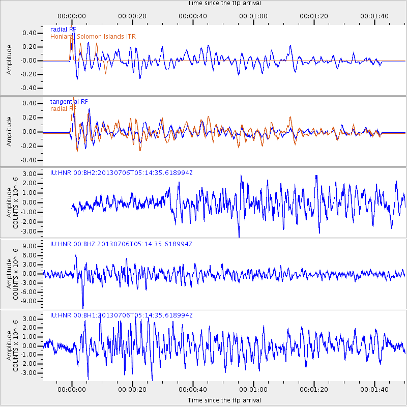
HNR Honiara, Solomon Islands - Earthquake Result Viewer
*The percent match for this event was below the threshold and hence no stack was calculated.
| Earthquake location: |
Southern Sumatra, Indonesia |
| Earthquake latitude/longitude: |
-3.3/100.6 |
| Earthquake time(UTC): |
2013/07/06 (187) 05:05:06 GMT |
| Earthquake Depth: |
21 km |
| Earthquake Magnitude: |
6.0 MW, 5.9 MB, 6.0 MW, 6.3 MS |
| Earthquake Catalog/Contributor: |
NEIC PDE/NEIC PDE-W |
|
| Network: |
IU Global Seismograph Network (GSN - IRIS/USGS) |
| Station: |
HNR Honiara, Solomon Islands |
| Lat/Lon: |
9.44 S/159.95 E |
| Elevation: |
100 m |
|
| Distance: |
59.3 deg |
| Az: |
98.981 deg |
| Baz: |
271.797 deg |
| Ray Param: |
$rayparam |
*The percent match for this event was below the threshold and hence was not used in the summary stack. |
|
| Radial Match: |
81.27251 % |
| Radial Bump: |
400 |
| Transverse Match: |
81.07837 % |
| Transverse Bump: |
400 |
| SOD ConfigId: |
512894 |
| Insert Time: |
2013-09-15 14:41:46.129 +0000 |
| GWidth: |
2.5 |
| Max Bumps: |
400 |
| Tol: |
0.001 |
|
Signal To Noise
| Channel | StoN | STA | LTA |
| IU:HNR:00:BHZ:20130706T05:14:35.618994Z | 6.4595075 | 3.643152E-6 | 5.639984E-7 |
| IU:HNR:00:BH1:20130706T05:14:35.618994Z | 2.4337323 | 1.0745048E-6 | 4.4150494E-7 |
| IU:HNR:00:BH2:20130706T05:14:35.618994Z | 2.17872 | 9.4108185E-7 | 4.3194257E-7 |
| Arrivals |
| Ps | |
| PpPs | |
| PsPs/PpSs | |


