MAJO Matsushiro, Japan - Earthquake Result Viewer
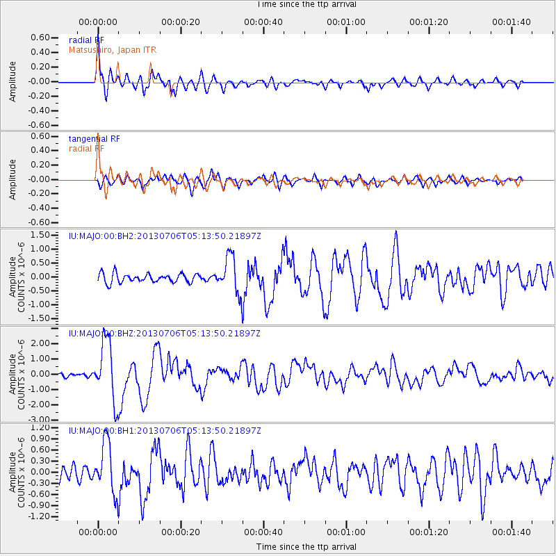
Earthquake location: Southern Sumatra, Indonesia
Earthquake latitude/longitude: -3.3/100.6
Earthquake time(UTC): 2013/07/06 (187) 05:05:06 GMT
Earthquake Depth: 21 km
Earthquake Magnitude: 6.0 MW, 5.9 MB, 6.0 MW, 6.3 MS
Earthquake Catalog/Contributor: NEIC PDE/NEIC PDE-W
Network: IU Global Seismograph Network (GSN - IRIS/USGS)
Station: MAJO Matsushiro, Japan
Lat/Lon: 36.55 N/138.20 E
Elevation: 405 m
Distance: 52.9 deg
Az: 38.062 deg
Baz: 229.85 deg
Ray Param: 0.06642603
Estimated Moho Depth: 29.75 km
Estimated Crust Vp/Vs: 1.99
Assumed Crust Vp: 6.461 km/s
Estimated Crust Vs: 3.243 km/s
Estimated Crust Poisson's Ratio: 0.33
Radial Match: 93.29489 %
Radial Bump: 400
Transverse Match: 82.089 %
Transverse Bump: 400
SOD ConfigId: 512894
Insert Time: 2013-09-15 14:42:14.043 +0000
GWidth: 2.5
Max Bumps: 400
Tol: 0.001

Signal To Noise

ChannelStoNSTALTA
IU:MAJO:00:BHZ:20130706T05:13:50.21897Z17.5530432.048179E-61.1668512E-7
IU:MAJO:00:BH1:20130706T05:13:50.21897Z5.2226047.136379E-71.3664409E-7
IU:MAJO:00:BH2:20130706T05:13:50.21897Z4.3540236.8803325E-71.5802242E-7
Arrivals
Ps4.8 SECOND
PpPs13 SECOND
PsPs/PpSs18 SECOND