You are here: Home > Network List > TA - USArray Transportable Network (new EarthScope stations) Stations List
> Station G59A Clarenceville, QC, USA > Earthquake Result Viewer
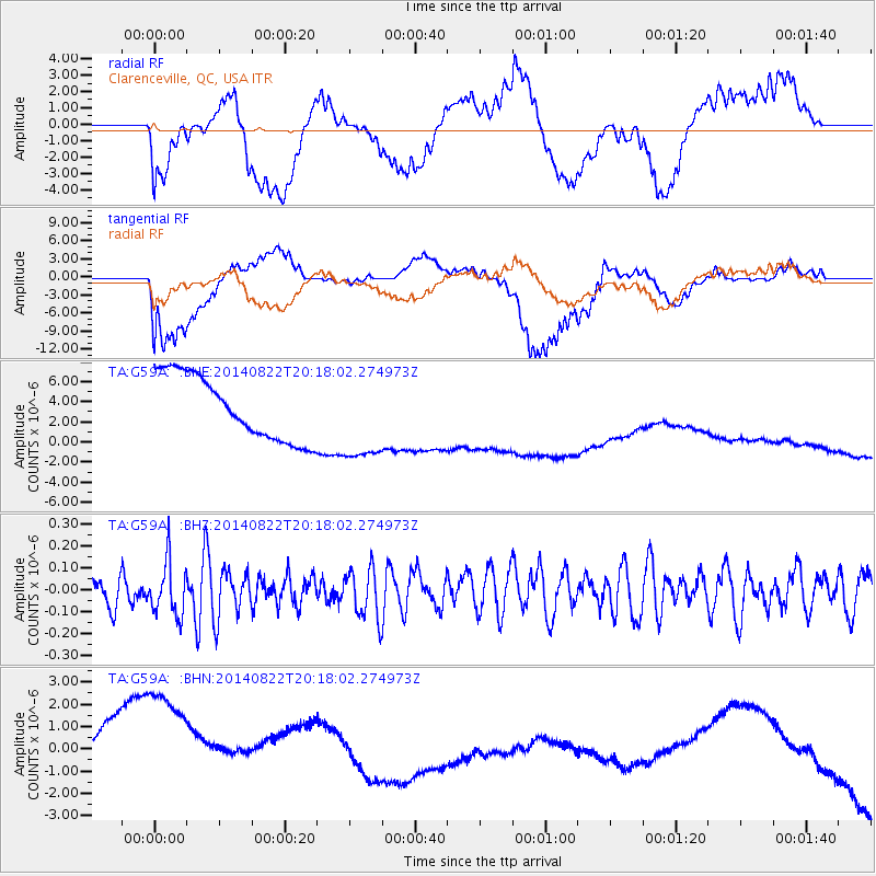
G59A Clarenceville, QC, USA - Earthquake Result Viewer
*The percent match for this event was below the threshold and hence no stack was calculated.
| Earthquake location: |
Iran-Iraq Border Region |
| Earthquake latitude/longitude: |
33.7/45.8 |
| Earthquake time(UTC): |
2014/08/22 (234) 20:06:04 GMT |
| Earthquake Depth: |
17 km |
| Earthquake Magnitude: |
5.0 MW, 5.4 mb, 5.1 Mwb, 5.4 mb_Lg |
| Earthquake Catalog/Contributor: |
ISC/ISC |
|
| Network: |
TA USArray Transportable Network (new EarthScope stations) |
| Station: |
G59A Clarenceville, QC, USA |
| Lat/Lon: |
45.08 N/73.18 W |
| Elevation: |
36 m |
|
| Distance: |
84.0 deg |
| Az: |
321.442 deg |
| Baz: |
47.175 deg |
| Ray Param: |
$rayparam |
*The percent match for this event was below the threshold and hence was not used in the summary stack. |
|
| Radial Match: |
53.793694 % |
| Radial Bump: |
400 |
| Transverse Match: |
46.791138 % |
| Transverse Bump: |
400 |
| SOD ConfigId: |
3390531 |
| Insert Time: |
2019-04-13 13:29:43.756 +0000 |
| GWidth: |
2.5 |
| Max Bumps: |
400 |
| Tol: |
0.001 |
|
Signal To Noise
| Channel | StoN | STA | LTA |
| TA:G59A: :BHZ:20140822T20:18:02.274973Z | 1.1925199 | 1.2339459E-7 | 1.0347381E-7 |
| TA:G59A: :BHN:20140822T20:18:02.274973Z | 1.9982078 | 4.2928273E-6 | 2.1483386E-6 |
| TA:G59A: :BHE:20140822T20:18:02.274973Z | 1.3949037 | 4.4566477E-6 | 3.1949503E-6 |
| Arrivals |
| Ps | |
| PpPs | |
| PsPs/PpSs | |


