You are here: Home > Network List > US - United States National Seismic Network Stations List
> Station MSO Missoula, Montana, USA > Earthquake Result Viewer
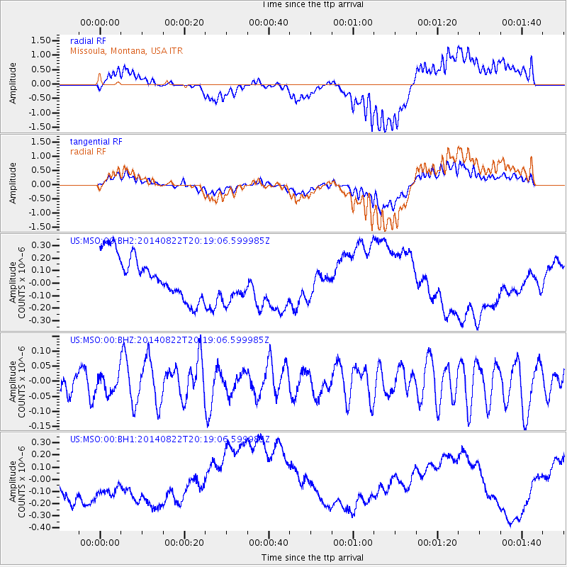
MSO Missoula, Montana, USA - Earthquake Result Viewer
*The percent match for this event was below the threshold and hence no stack was calculated.
| Earthquake location: |
Iran-Iraq Border Region |
| Earthquake latitude/longitude: |
33.7/45.8 |
| Earthquake time(UTC): |
2014/08/22 (234) 20:06:04 GMT |
| Earthquake Depth: |
17 km |
| Earthquake Magnitude: |
5.0 MW, 5.4 mb, 5.1 Mwb, 5.4 mb_Lg |
| Earthquake Catalog/Contributor: |
ISC/ISC |
|
| Network: |
US United States National Seismic Network |
| Station: |
MSO Missoula, Montana, USA |
| Lat/Lon: |
46.83 N/113.94 W |
| Elevation: |
1264 m |
|
| Distance: |
97.8 deg |
| Az: |
346.097 deg |
| Baz: |
16.962 deg |
| Ray Param: |
$rayparam |
*The percent match for this event was below the threshold and hence was not used in the summary stack. |
|
| Radial Match: |
60.215347 % |
| Radial Bump: |
400 |
| Transverse Match: |
55.323925 % |
| Transverse Bump: |
400 |
| SOD ConfigId: |
3390531 |
| Insert Time: |
2019-04-13 13:30:53.515 +0000 |
| GWidth: |
2.5 |
| Max Bumps: |
400 |
| Tol: |
0.001 |
|
Signal To Noise
| Channel | StoN | STA | LTA |
| US:MSO:00:BHZ:20140822T20:19:06.599985Z | 0.637517 | 3.2611048E-8 | 5.1153226E-8 |
| US:MSO:00:BH1:20140822T20:19:06.599985Z | 1.0656633 | 2.0440339E-7 | 1.9180861E-7 |
| US:MSO:00:BH2:20140822T20:19:06.599985Z | 1.0393375 | 1.7853888E-7 | 1.7178144E-7 |
| Arrivals |
| Ps | |
| PpPs | |
| PsPs/PpSs | |


