You are here: Home > Network List > X812 - Deep Structure of Three Continental Sutures in Eastern North America Stations List
> Station QM20 Hay Lake, Maine, USA > Earthquake Result Viewer
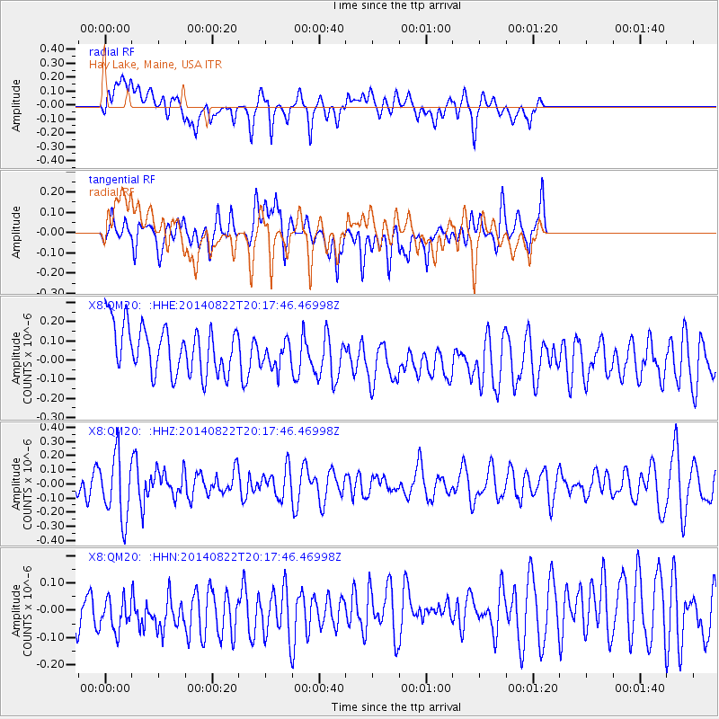
QM20 Hay Lake, Maine, USA - Earthquake Result Viewer
*The percent match for this event was below the threshold and hence no stack was calculated.
| Earthquake location: |
Iran-Iraq Border Region |
| Earthquake latitude/longitude: |
33.7/45.8 |
| Earthquake time(UTC): |
2014/08/22 (234) 20:06:04 GMT |
| Earthquake Depth: |
17 km |
| Earthquake Magnitude: |
5.0 MW, 5.4 mb, 5.1 Mwb, 5.4 mb_Lg |
| Earthquake Catalog/Contributor: |
ISC/ISC |
|
| Network: |
X8 Deep Structure of Three Continental Sutures in Eastern North America |
| Station: |
QM20 Hay Lake, Maine, USA |
| Lat/Lon: |
46.13 N/68.72 W |
| Elevation: |
207 m |
|
| Distance: |
81.0 deg |
| Az: |
320.15 deg |
| Baz: |
50.184 deg |
| Ray Param: |
$rayparam |
*The percent match for this event was below the threshold and hence was not used in the summary stack. |
|
| Radial Match: |
47.62286 % |
| Radial Bump: |
400 |
| Transverse Match: |
51.363216 % |
| Transverse Bump: |
400 |
| SOD ConfigId: |
3390531 |
| Insert Time: |
2019-04-13 13:31:12.511 +0000 |
| GWidth: |
2.5 |
| Max Bumps: |
400 |
| Tol: |
0.001 |
|
Signal To Noise
| Channel | StoN | STA | LTA |
| X8:QM20: :HHZ:20140822T20:17:46.46998Z | 2.2945986 | 2.2266804E-7 | 9.704008E-8 |
| X8:QM20: :HHN:20140822T20:17:46.46998Z | 0.9722766 | 8.629873E-8 | 8.875944E-8 |
| X8:QM20: :HHE:20140822T20:17:46.46998Z | 0.6273125 | 7.723552E-8 | 1.2312128E-7 |
| Arrivals |
| Ps | |
| PpPs | |
| PsPs/PpSs | |


