You are here: Home > Network List > TA - USArray Transportable Network (new EarthScope stations) Stations List
> Station Q51A Peebles, OH, USA > Earthquake Result Viewer
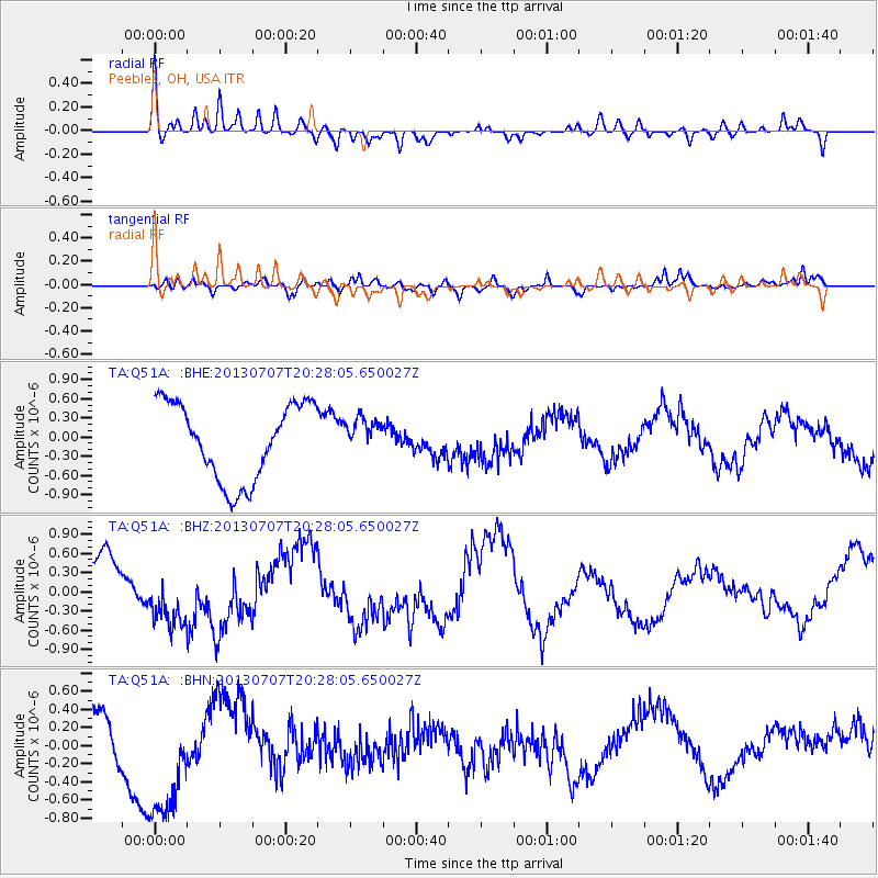
Q51A Peebles, OH, USA - Earthquake Result Viewer
*The percent match for this event was below the threshold and hence no stack was calculated.
| Earthquake location: |
Andreanof Islands, Aleutian Is. |
| Earthquake latitude/longitude: |
51.0/-179.9 |
| Earthquake time(UTC): |
2013/07/07 (188) 20:17:59 GMT |
| Earthquake Depth: |
6.8 km |
| Earthquake Magnitude: |
5.6 MB, 5.5 ML |
| Earthquake Catalog/Contributor: |
NEIC PDE/NEIC PDE-W |
|
| Network: |
TA USArray Transportable Network (new EarthScope stations) |
| Station: |
Q51A Peebles, OH, USA |
| Lat/Lon: |
39.03 N/83.35 W |
| Elevation: |
362 m |
|
| Distance: |
64.5 deg |
| Az: |
58.996 deg |
| Baz: |
315.983 deg |
| Ray Param: |
$rayparam |
*The percent match for this event was below the threshold and hence was not used in the summary stack. |
|
| Radial Match: |
53.961586 % |
| Radial Bump: |
400 |
| Transverse Match: |
52.94329 % |
| Transverse Bump: |
400 |
| SOD ConfigId: |
512894 |
| Insert Time: |
2013-09-15 15:45:12.576 +0000 |
| GWidth: |
2.5 |
| Max Bumps: |
400 |
| Tol: |
0.001 |
|
Signal To Noise
| Channel | StoN | STA | LTA |
| TA:Q51A: :BHZ:20130707T20:28:05.650027Z | 0.9154941 | 4.0638162E-7 | 4.438932E-7 |
| TA:Q51A: :BHN:20130707T20:28:05.650027Z | 3.6667647 | 7.383063E-7 | 2.0135087E-7 |
| TA:Q51A: :BHE:20130707T20:28:05.650027Z | 0.44437078 | 2.6448734E-7 | 5.9519516E-7 |
| Arrivals |
| Ps | |
| PpPs | |
| PsPs/PpSs | |


