PASS Maple Falls, WA, USA - Earthquake Result Viewer
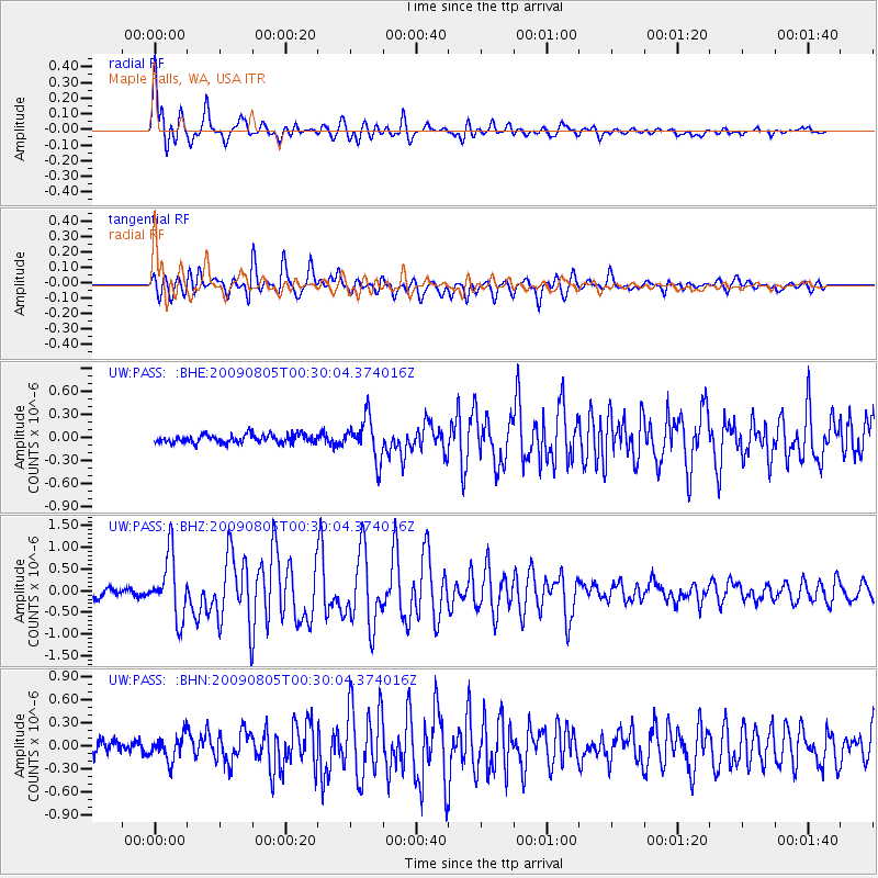
Earthquake location: Southwestern Ryukyu Isl., Japan
Earthquake latitude/longitude: 24.2/125.1
Earthquake time(UTC): 2009/08/05 (217) 00:17:58 GMT
Earthquake Depth: 25 km
Earthquake Magnitude: 5.9 MB, 5.9 MS, 6.2 MW, 6.1 MW
Earthquake Catalog/Contributor: WHDF/NEIC
Network: UW Pacific Northwest Regional Seismic Network
Station: PASS Maple Falls, WA, USA
Lat/Lon: 49.00 N/122.09 W
Elevation: 174 m
Distance: 85.8 deg
Az: 37.496 deg
Baz: 302.46 deg
Ray Param: 0.044507455
Estimated Moho Depth: 51.75 km
Estimated Crust Vp/Vs: 2.00
Assumed Crust Vp: 6.566 km/s
Estimated Crust Vs: 3.279 km/s
Estimated Crust Poisson's Ratio: 0.33
Radial Match: 88.09677 %
Radial Bump: 400
Transverse Match: 86.36404 %
Transverse Bump: 400
SOD ConfigId: 2622
Insert Time: 2010-02-27 04:57:34.411 +0000
GWidth: 2.5
Max Bumps: 400
Tol: 0.001

Signal To Noise

ChannelStoNSTALTA
UW:PASS: :BHZ:20090805T00:30:04.374016Z8.1774527.18194E-78.782614E-8
UW:PASS: :BHN:20090805T00:30:04.374016Z2.43859861.593909E-76.5361675E-8
UW:PASS: :BHE:20090805T00:30:04.374016Z4.8728752.6393704E-75.4164538E-8
Arrivals
Ps8.1 SECOND
PpPs23 SECOND
PsPs/PpSs31 SECOND