PASS Maple Falls, WA, USA - Earthquake Result Viewer
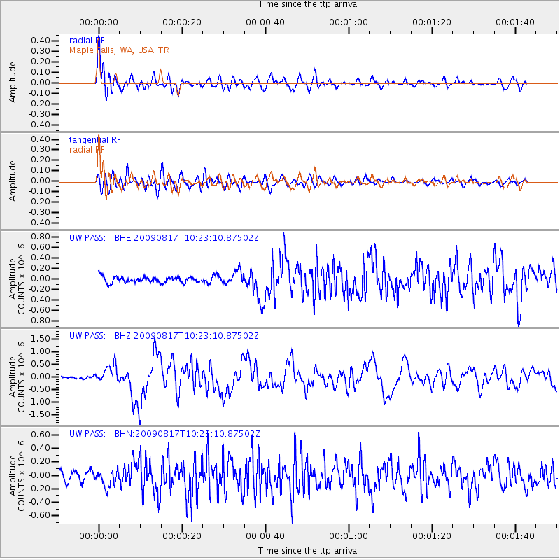
Earthquake location: Southwestern Ryukyu Isl., Japan
Earthquake latitude/longitude: 23.4/123.5
Earthquake time(UTC): 2009/08/17 (229) 10:10:55 GMT
Earthquake Depth: 10 km
Earthquake Magnitude: 5.9 MB, 6.2 MS, 6.1 MW, 6.1 MW
Earthquake Catalog/Contributor: WHDF/NEIC
Network: UW Pacific Northwest Regional Seismic Network
Station: PASS Maple Falls, WA, USA
Lat/Lon: 49.00 N/122.09 W
Elevation: 174 m
Distance: 87.3 deg
Az: 36.907 deg
Baz: 303.117 deg
Ray Param: 0.04344528
Estimated Moho Depth: 10.0 km
Estimated Crust Vp/Vs: 1.79
Assumed Crust Vp: 6.566 km/s
Estimated Crust Vs: 3.679 km/s
Estimated Crust Poisson's Ratio: 0.27
Radial Match: 85.98499 %
Radial Bump: 400
Transverse Match: 78.725235 %
Transverse Bump: 400
SOD ConfigId: 2622
Insert Time: 2010-02-27 04:57:53.758 +0000
GWidth: 2.5
Max Bumps: 400
Tol: 0.001

Signal To Noise

ChannelStoNSTALTA
UW:PASS: :BHZ:20090817T10:23:10.87502Z5.10963543.456927E-76.765506E-8
UW:PASS: :BHN:20090817T10:23:10.87502Z2.05483151.1917002E-75.799503E-8
UW:PASS: :BHE:20090817T10:23:10.87502Z2.35118371.2821272E-75.453114E-8
Arrivals
Ps1.2 SECOND
PpPs4.1 SECOND
PsPs/PpSs5.4 SECOND