
PASS Maple Falls, WA, USA - Earthquake Result Viewer
| ||||||||||||||||||
| ||||||||||||||||||
| ||||||||||||||||||
|
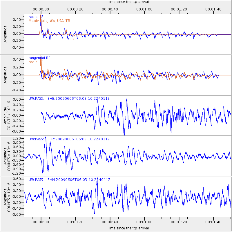
Signal To Noise
| Channel | StoN | STA | LTA |
| UW:PASS: :BHZ:20090606T06:03:10.224011Z | 8.068793 | 7.222081E-7 | 8.950634E-8 |
| UW:PASS: :BHN:20090606T06:03:10.224011Z | 1.7730901 | 1.8963411E-7 | 1.069512E-7 |
| UW:PASS: :BHE:20090606T06:03:10.224011Z | 3.787297 | 2.7705653E-7 | 7.315416E-8 |
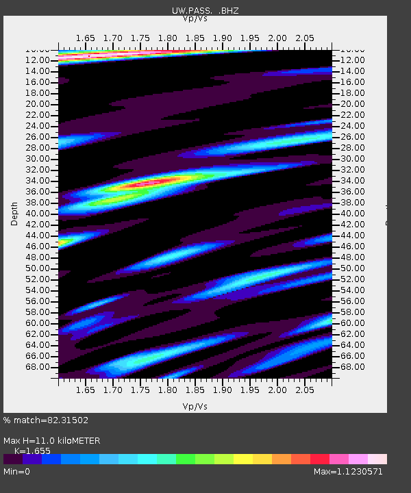
| Arrivals | |
| Ps | 1.1 SECOND |
| PpPs | 4.3 SECOND |
| PsPs/PpSs | 5.4 SECOND |

