You are here: Home > Network List > CN - Canadian National Seismograph Network Stations List
> Station INK INUVIK, NT > Earthquake Result Viewer
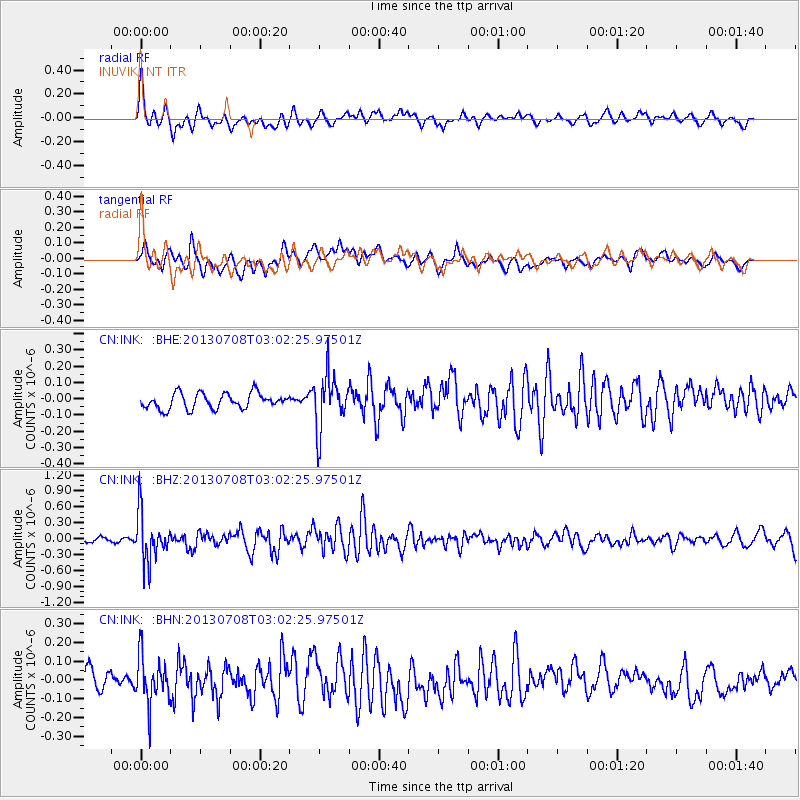
INK INUVIK, NT - Earthquake Result Viewer
*The percent match for this event was below the threshold and hence no stack was calculated.
| Earthquake location: |
El Salvador |
| Earthquake latitude/longitude: |
13.3/-89.2 |
| Earthquake time(UTC): |
2013/07/08 (189) 02:52:42 GMT |
| Earthquake Depth: |
55 km |
| Earthquake Magnitude: |
5.7 MW, 5.7 MB, 5.7 MW |
| Earthquake Catalog/Contributor: |
NEIC PDE/NEIC PDE-W |
|
| Network: |
CN Canadian National Seismograph Network |
| Station: |
INK INUVIK, NT |
| Lat/Lon: |
68.31 N/133.53 W |
| Elevation: |
44 m |
|
| Distance: |
61.9 deg |
| Az: |
342.866 deg |
| Baz: |
129.513 deg |
| Ray Param: |
$rayparam |
*The percent match for this event was below the threshold and hence was not used in the summary stack. |
|
| Radial Match: |
76.54256 % |
| Radial Bump: |
400 |
| Transverse Match: |
63.978592 % |
| Transverse Bump: |
400 |
| SOD ConfigId: |
512894 |
| Insert Time: |
2013-09-15 16:32:23.895 +0000 |
| GWidth: |
2.5 |
| Max Bumps: |
400 |
| Tol: |
0.001 |
|
Signal To Noise
| Channel | StoN | STA | LTA |
| CN:INK: :BHZ:20130708T03:02:25.97501Z | 10.297694 | 4.507801E-7 | 4.3774854E-8 |
| CN:INK: :BHN:20130708T03:02:25.97501Z | 2.5641904 | 1.2735148E-7 | 4.9665378E-8 |
| CN:INK: :BHE:20130708T03:02:25.97501Z | 3.5134938 | 1.6641691E-7 | 4.7365077E-8 |
| Arrivals |
| Ps | |
| PpPs | |
| PsPs/PpSs | |


