You are here: Home > Network List > UW - Pacific Northwest Regional Seismic Network Stations List
> Station PASS Maple Falls, WA, USA > Earthquake Result Viewer
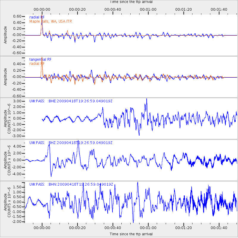
PASS Maple Falls, WA, USA - Earthquake Result Viewer
*The percent match for this event was below the threshold and hence no stack was calculated.
| Earthquake location: |
Kuril Islands |
| Earthquake latitude/longitude: |
46.0/151.4 |
| Earthquake time(UTC): |
2009/04/18 (108) 19:17:58 GMT |
| Earthquake Depth: |
35 km |
| Earthquake Magnitude: |
6.3 MB, 6.3 MS, 6.6 MW, 6.4 MW |
| Earthquake Catalog/Contributor: |
WHDF/NEIC |
|
| Network: |
UW Pacific Northwest Regional Seismic Network |
| Station: |
PASS Maple Falls, WA, USA |
| Lat/Lon: |
49.00 N/122.09 W |
| Elevation: |
174 m |
|
| Distance: |
55.4 deg |
| Az: |
52.993 deg |
| Baz: |
302.328 deg |
| Ray Param: |
$rayparam |
*The percent match for this event was below the threshold and hence was not used in the summary stack. |
|
| Radial Match: |
74.46347 % |
| Radial Bump: |
400 |
| Transverse Match: |
70.24853 % |
| Transverse Bump: |
400 |
| SOD ConfigId: |
2760 |
| Insert Time: |
2010-02-27 04:58:28.254 +0000 |
| GWidth: |
2.5 |
| Max Bumps: |
400 |
| Tol: |
0.001 |
|
Signal To Noise
| Channel | StoN | STA | LTA |
| UW:PASS: :BHZ:20090418T19:26:59.049019Z | 4.5593414 | 2.0577413E-6 | 4.513242E-7 |
| UW:PASS: :BHN:20090418T19:26:59.049019Z | 1.675953 | 5.6422016E-7 | 3.366563E-7 |
| UW:PASS: :BHE:20090418T19:26:59.049019Z | 2.5721116 | 7.6823136E-7 | 2.9867732E-7 |
| Arrivals |
| Ps | |
| PpPs | |
| PsPs/PpSs | |


