You are here: Home > Network List > UW - Pacific Northwest Regional Seismic Network Stations List
> Station PASS Maple Falls, WA, USA > Earthquake Result Viewer
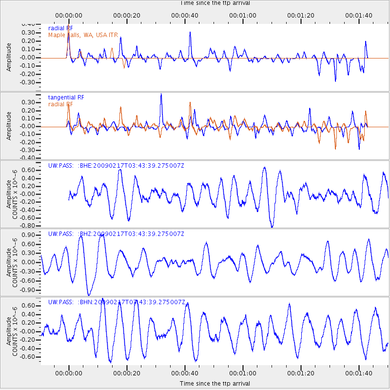
PASS Maple Falls, WA, USA - Earthquake Result Viewer
*The percent match for this event was below the threshold and hence no stack was calculated.
| Earthquake location: |
Kermadec Islands, New Zealand |
| Earthquake latitude/longitude: |
-30.7/-178.6 |
| Earthquake time(UTC): |
2009/02/17 (048) 03:30:53 GMT |
| Earthquake Depth: |
13 km |
| Earthquake Magnitude: |
5.5 MS, 5.4 MB, 6.0 MW, 6.0 MW |
| Earthquake Catalog/Contributor: |
WHDF/NEIC |
|
| Network: |
UW Pacific Northwest Regional Seismic Network |
| Station: |
PASS Maple Falls, WA, USA |
| Lat/Lon: |
49.00 N/122.09 W |
| Elevation: |
174 m |
|
| Distance: |
94.0 deg |
| Az: |
33.417 deg |
| Baz: |
226.064 deg |
| Ray Param: |
$rayparam |
*The percent match for this event was below the threshold and hence was not used in the summary stack. |
|
| Radial Match: |
54.920525 % |
| Radial Bump: |
400 |
| Transverse Match: |
55.582993 % |
| Transverse Bump: |
328 |
| SOD ConfigId: |
2658 |
| Insert Time: |
2010-02-27 04:58:36.572 +0000 |
| GWidth: |
2.5 |
| Max Bumps: |
400 |
| Tol: |
0.001 |
|
Signal To Noise
| Channel | StoN | STA | LTA |
| UW:PASS: :BHZ:20090217T03:43:39.275007Z | 2.17006 | 5.481173E-7 | 2.5258166E-7 |
| UW:PASS: :BHN:20090217T03:43:39.275007Z | 1.0057216 | 2.1265787E-7 | 2.1144804E-7 |
| UW:PASS: :BHE:20090217T03:43:39.275007Z | 0.34725574 | 1.047042E-7 | 3.01519E-7 |
| Arrivals |
| Ps | |
| PpPs | |
| PsPs/PpSs | |


