You are here: Home > Network List > UW - Pacific Northwest Regional Seismic Network Stations List
> Station PASS Maple Falls, WA, USA > Earthquake Result Viewer
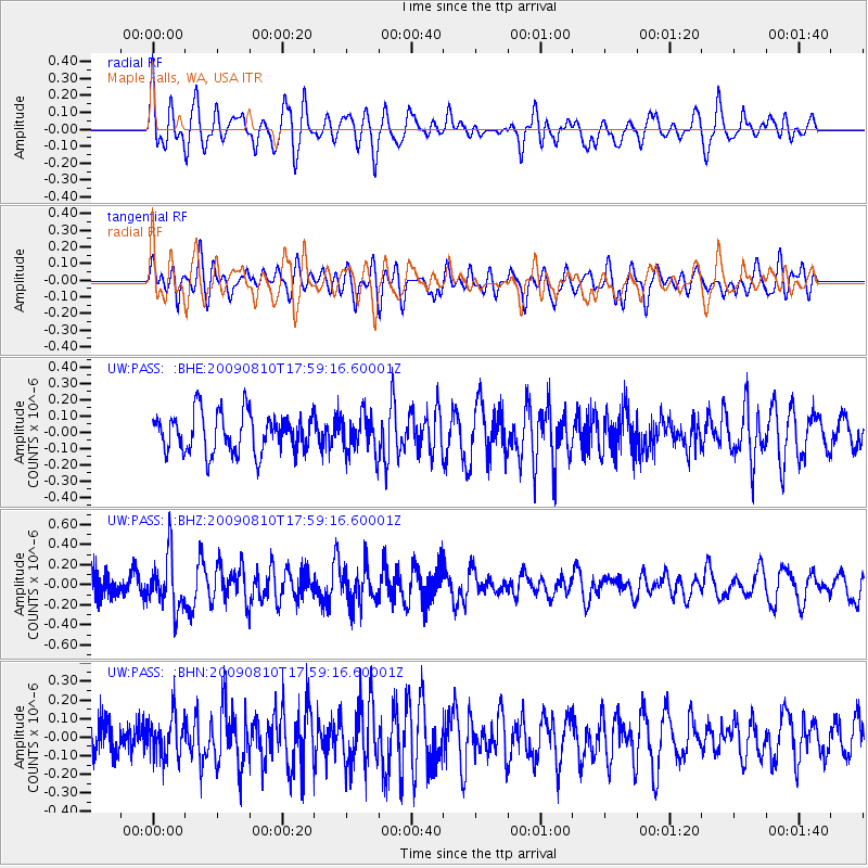
PASS Maple Falls, WA, USA - Earthquake Result Viewer
*The percent match for this event was below the threshold and hence no stack was calculated.
| Earthquake location: |
Near N Coast Of New Guinea, P.N.G. |
| Earthquake latitude/longitude: |
-3.1/143.2 |
| Earthquake time(UTC): |
2009/08/10 (222) 17:46:23 GMT |
| Earthquake Depth: |
10 km |
| Earthquake Magnitude: |
5.9 MB, 5.6 MW, 5.6 MW |
| Earthquake Catalog/Contributor: |
WHDF/NEIC |
|
| Network: |
UW Pacific Northwest Regional Seismic Network |
| Station: |
PASS Maple Falls, WA, USA |
| Lat/Lon: |
49.00 N/122.09 W |
| Elevation: |
174 m |
|
| Distance: |
95.4 deg |
| Az: |
41.249 deg |
| Baz: |
271.5 deg |
| Ray Param: |
$rayparam |
*The percent match for this event was below the threshold and hence was not used in the summary stack. |
|
| Radial Match: |
66.34079 % |
| Radial Bump: |
400 |
| Transverse Match: |
54.58309 % |
| Transverse Bump: |
400 |
| SOD ConfigId: |
2622 |
| Insert Time: |
2010-02-27 04:58:45.868 +0000 |
| GWidth: |
2.5 |
| Max Bumps: |
400 |
| Tol: |
0.001 |
|
Signal To Noise
| Channel | StoN | STA | LTA |
| UW:PASS: :BHZ:20090810T17:59:16.60001Z | 3.0438833 | 2.635245E-7 | 8.657509E-8 |
| UW:PASS: :BHN:20090810T17:59:16.60001Z | 1.3705444 | 1.1171363E-7 | 8.151041E-8 |
| UW:PASS: :BHE:20090810T17:59:16.60001Z | 0.9679352 | 1.17344094E-7 | 1.2123135E-7 |
| Arrivals |
| Ps | |
| PpPs | |
| PsPs/PpSs | |


