You are here: Home > Network List > UW - Pacific Northwest Regional Seismic Network Stations List
> Station PASS Maple Falls, WA, USA > Earthquake Result Viewer
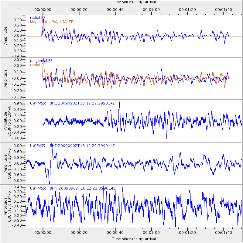
PASS Maple Falls, WA, USA - Earthquake Result Viewer
*The percent match for this event was below the threshold and hence no stack was calculated.
| Earthquake location: |
Kermadec Islands, New Zealand |
| Earthquake latitude/longitude: |
-29.4/-179.0 |
| Earthquake time(UTC): |
2009/09/02 (245) 18:00:11 GMT |
| Earthquake Depth: |
275 km |
| Earthquake Magnitude: |
5.8 MB, 6.2 MW, 6.1 MW |
| Earthquake Catalog/Contributor: |
WHDF/NEIC |
|
| Network: |
UW Pacific Northwest Regional Seismic Network |
| Station: |
PASS Maple Falls, WA, USA |
| Lat/Lon: |
49.00 N/122.09 W |
| Elevation: |
174 m |
|
| Distance: |
93.0 deg |
| Az: |
33.525 deg |
| Baz: |
227.064 deg |
| Ray Param: |
$rayparam |
*The percent match for this event was below the threshold and hence was not used in the summary stack. |
|
| Radial Match: |
68.66726 % |
| Radial Bump: |
400 |
| Transverse Match: |
56.84867 % |
| Transverse Bump: |
400 |
| SOD ConfigId: |
2622 |
| Insert Time: |
2010-02-27 04:58:49.903 +0000 |
| GWidth: |
2.5 |
| Max Bumps: |
400 |
| Tol: |
0.001 |
|
Signal To Noise
| Channel | StoN | STA | LTA |
| UW:PASS: :BHZ:20090902T18:12:22.399014Z | 5.468039 | 4.954226E-7 | 9.060335E-8 |
| UW:PASS: :BHN:20090902T18:12:22.399014Z | 1.5513887 | 1.2529202E-7 | 8.0761204E-8 |
| UW:PASS: :BHE:20090902T18:12:22.399014Z | 1.3320118 | 8.796515E-8 | 6.603931E-8 |
| Arrivals |
| Ps | |
| PpPs | |
| PsPs/PpSs | |


