You are here: Home > Network List > US - United States National Seismic Network Stations List
> Station DGMT Dagmar, Montana, USA > Earthquake Result Viewer
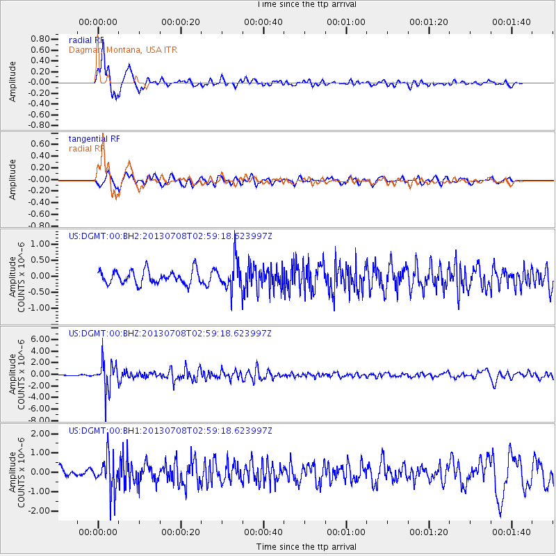
DGMT Dagmar, Montana, USA - Earthquake Result Viewer
*The percent match for this event was below the threshold and hence no stack was calculated.
| Earthquake location: |
El Salvador |
| Earthquake latitude/longitude: |
13.3/-89.2 |
| Earthquake time(UTC): |
2013/07/08 (189) 02:52:42 GMT |
| Earthquake Depth: |
55 km |
| Earthquake Magnitude: |
5.7 MW, 5.7 MB, 5.7 MW |
| Earthquake Catalog/Contributor: |
NEIC PDE/NEIC PDE-W |
|
| Network: |
US United States National Seismic Network |
| Station: |
DGMT Dagmar, Montana, USA |
| Lat/Lon: |
48.47 N/104.20 W |
| Elevation: |
0.0 m |
|
| Distance: |
37.2 deg |
| Az: |
343.432 deg |
| Baz: |
155.345 deg |
| Ray Param: |
$rayparam |
*The percent match for this event was below the threshold and hence was not used in the summary stack. |
|
| Radial Match: |
80.085976 % |
| Radial Bump: |
400 |
| Transverse Match: |
64.41395 % |
| Transverse Bump: |
400 |
| SOD ConfigId: |
512894 |
| Insert Time: |
2013-09-15 16:51:35.021 +0000 |
| GWidth: |
2.5 |
| Max Bumps: |
400 |
| Tol: |
0.001 |
|
Signal To Noise
| Channel | StoN | STA | LTA |
| US:DGMT:00:BHZ:20130708T02:59:18.623997Z | 18.690407 | 2.3850348E-6 | 1.2760744E-7 |
| US:DGMT:00:BH1:20130708T02:59:18.623997Z | 4.736328 | 9.0916666E-7 | 1.9195602E-7 |
| US:DGMT:00:BH2:20130708T02:59:18.623997Z | 2.1222672 | 4.380989E-7 | 2.0642966E-7 |
| Arrivals |
| Ps | |
| PpPs | |
| PsPs/PpSs | |


