You are here: Home > Network List > UW - Pacific Northwest Regional Seismic Network Stations List
> Station PASS Maple Falls, WA, USA > Earthquake Result Viewer
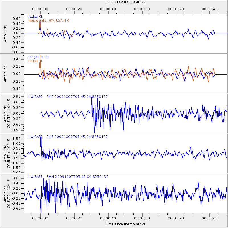
PASS Maple Falls, WA, USA - Earthquake Result Viewer
*The percent match for this event was below the threshold and hence no stack was calculated.
| Earthquake location: |
Rat Islands, Aleutian Islands |
| Earthquake latitude/longitude: |
52.2/178.1 |
| Earthquake time(UTC): |
2009/10/07 (280) 05:38:37 GMT |
| Earthquake Depth: |
138 km |
| Earthquake Magnitude: |
5.6 MB, 5.6 MW, 5.6 MW |
| Earthquake Catalog/Contributor: |
WHDF/NEIC |
|
| Network: |
UW Pacific Northwest Regional Seismic Network |
| Station: |
PASS Maple Falls, WA, USA |
| Lat/Lon: |
49.00 N/122.09 W |
| Elevation: |
174 m |
|
| Distance: |
37.2 deg |
| Az: |
70.371 deg |
| Baz: |
298.227 deg |
| Ray Param: |
$rayparam |
*The percent match for this event was below the threshold and hence was not used in the summary stack. |
|
| Radial Match: |
59.854404 % |
| Radial Bump: |
400 |
| Transverse Match: |
62.048492 % |
| Transverse Bump: |
400 |
| SOD ConfigId: |
2622 |
| Insert Time: |
2010-02-27 04:59:06.464 +0000 |
| GWidth: |
2.5 |
| Max Bumps: |
400 |
| Tol: |
0.001 |
|
Signal To Noise
| Channel | StoN | STA | LTA |
| UW:PASS: :BHZ:20091007T05:45:04.825013Z | 4.027127 | 5.515678E-7 | 1.369631E-7 |
| UW:PASS: :BHN:20091007T05:45:04.825013Z | 2.4670467 | 3.234197E-7 | 1.3109589E-7 |
| UW:PASS: :BHE:20091007T05:45:04.825013Z | 4.2335362 | 4.291898E-7 | 1.0137856E-7 |
| Arrivals |
| Ps | |
| PpPs | |
| PsPs/PpSs | |


