You are here: Home > Network List > UW - Pacific Northwest Regional Seismic Network Stations List
> Station PASS Maple Falls, WA, USA > Earthquake Result Viewer
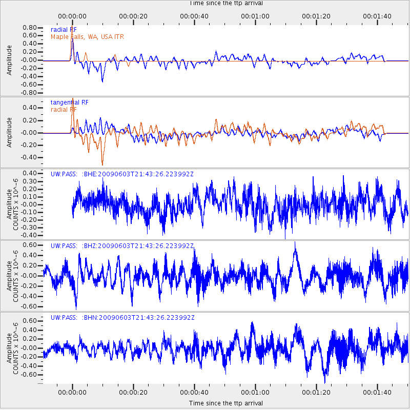
PASS Maple Falls, WA, USA - Earthquake Result Viewer
*The percent match for this event was below the threshold and hence no stack was calculated.
| Earthquake location: |
Revilla Gigedo Islands Region |
| Earthquake latitude/longitude: |
19.6/-109.2 |
| Earthquake time(UTC): |
2009/06/03 (154) 21:37:37 GMT |
| Earthquake Depth: |
6.0 km |
| Earthquake Magnitude: |
5.6 MW, 5.1 MS, 5.2 MB, 5.5 MW |
| Earthquake Catalog/Contributor: |
WHDF/NEIC |
|
| Network: |
UW Pacific Northwest Regional Seismic Network |
| Station: |
PASS Maple Falls, WA, USA |
| Lat/Lon: |
49.00 N/122.09 W |
| Elevation: |
174 m |
|
| Distance: |
31.2 deg |
| Az: |
343.467 deg |
| Baz: |
155.954 deg |
| Ray Param: |
$rayparam |
*The percent match for this event was below the threshold and hence was not used in the summary stack. |
|
| Radial Match: |
69.89917 % |
| Radial Bump: |
400 |
| Transverse Match: |
38.018143 % |
| Transverse Bump: |
400 |
| SOD ConfigId: |
2648 |
| Insert Time: |
2010-02-27 04:59:18.668 +0000 |
| GWidth: |
2.5 |
| Max Bumps: |
400 |
| Tol: |
0.001 |
|
Signal To Noise
| Channel | StoN | STA | LTA |
| UW:PASS: :BHZ:20090603T21:43:26.223992Z | 2.3677983 | 2.5188936E-7 | 1.0638126E-7 |
| UW:PASS: :BHN:20090603T21:43:26.223992Z | 1.3377099 | 1.1766664E-7 | 8.796125E-8 |
| UW:PASS: :BHE:20090603T21:43:26.223992Z | 1.4940231 | 1.553079E-7 | 1.03952814E-7 |
| Arrivals |
| Ps | |
| PpPs | |
| PsPs/PpSs | |


