You are here: Home > Network List > TJ - Tajikistan National Seismic Network Stations List
> Station GARM Garm, Tajikistan > Earthquake Result Viewer
GARM Garm, Tajikistan - Earthquake Result Viewer
*The percent match for this event was below the threshold and hence no stack was calculated.
| Earthquake location: |
Red Sea |
| Earthquake latitude/longitude: |
16.7/40.8 |
| Earthquake time(UTC): |
2013/07/08 (189) 15:30:28 GMT |
| Earthquake Depth: |
10 km |
| Earthquake Magnitude: |
5.6 MW, 5.5 MW |
| Earthquake Catalog/Contributor: |
NEIC PDE/NEIC PDE-W |
|
| Network: |
TJ Tajikistan National Seismic Network |
| Station: |
GARM Garm, Tajikistan |
| Lat/Lon: |
39.00 N/70.32 E |
| Elevation: |
1305 m |
|
| Distance: |
34.0 deg |
| Az: |
43.31 deg |
| Baz: |
237.524 deg |
| Ray Param: |
$rayparam |
*The percent match for this event was below the threshold and hence was not used in the summary stack. |
|
| Radial Match: |
70.37593 % |
| Radial Bump: |
400 |
| Transverse Match: |
62.507153 % |
| Transverse Bump: |
400 |
| SOD ConfigId: |
512894 |
| Insert Time: |
2013-09-15 17:08:20.348 +0000 |
| GWidth: |
2.5 |
| Max Bumps: |
400 |
| Tol: |
0.001 |
|
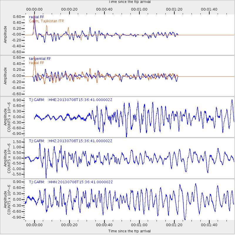
Signal To Noise
| Channel | StoN | STA | LTA |
| TJ:GARM: :HHZ:20130708T15:36:41.000002Z | 4.893943 | 4.4717618E-7 | 9.1373394E-8 |
| TJ:GARM: :HHN:20130708T15:36:41.000002Z | 1.5520217 | 1.7181141E-7 | 1.1070168E-7 |
| TJ:GARM: :HHE:20130708T15:36:41.000002Z | 2.157567 | 1.7653504E-7 | 8.1821355E-8 |
| Arrivals |
| Ps | |
| PpPs | |
| PsPs/PpSs | |


