You are here: Home > Network List > UW - Pacific Northwest Regional Seismic Network Stations List
> Station PASS Maple Falls, WA, USA > Earthquake Result Viewer
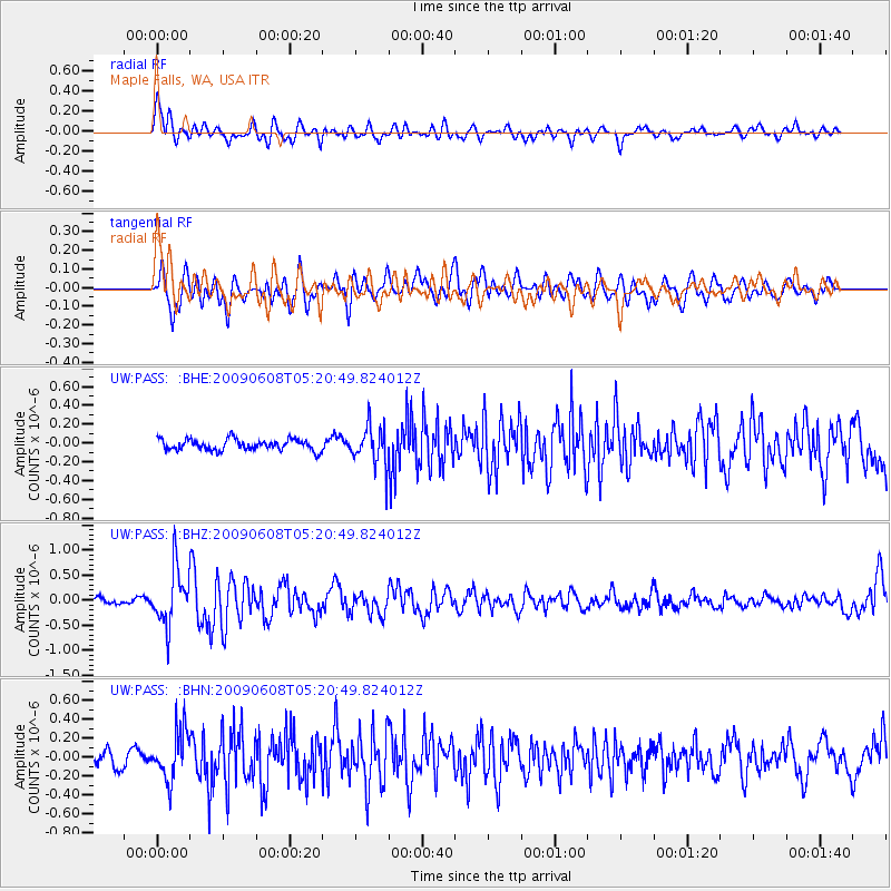
PASS Maple Falls, WA, USA - Earthquake Result Viewer
*The percent match for this event was below the threshold and hence no stack was calculated.
| Earthquake location: |
Honduras |
| Earthquake latitude/longitude: |
15.8/-86.9 |
| Earthquake time(UTC): |
2009/06/08 (159) 05:13:14 GMT |
| Earthquake Depth: |
10 km |
| Earthquake Magnitude: |
5.5 MB, 4.9 MS, 5.4 MW, 5.4 MW |
| Earthquake Catalog/Contributor: |
WHDF/NEIC |
|
| Network: |
UW Pacific Northwest Regional Seismic Network |
| Station: |
PASS Maple Falls, WA, USA |
| Lat/Lon: |
49.00 N/122.09 W |
| Elevation: |
174 m |
|
| Distance: |
43.8 deg |
| Az: |
326.733 deg |
| Baz: |
126.691 deg |
| Ray Param: |
$rayparam |
*The percent match for this event was below the threshold and hence was not used in the summary stack. |
|
| Radial Match: |
72.262344 % |
| Radial Bump: |
400 |
| Transverse Match: |
65.76219 % |
| Transverse Bump: |
400 |
| SOD ConfigId: |
2648 |
| Insert Time: |
2010-02-27 04:59:24.224 +0000 |
| GWidth: |
2.5 |
| Max Bumps: |
400 |
| Tol: |
0.001 |
|
Signal To Noise
| Channel | StoN | STA | LTA |
| UW:PASS: :BHZ:20090608T05:20:49.824012Z | 9.362649 | 5.5357737E-7 | 5.9126148E-8 |
| UW:PASS: :BHN:20090608T05:20:49.824012Z | 2.7311993 | 2.5995686E-7 | 9.518048E-8 |
| UW:PASS: :BHE:20090608T05:20:49.824012Z | 3.576563 | 2.0736059E-7 | 5.7977616E-8 |
| Arrivals |
| Ps | |
| PpPs | |
| PsPs/PpSs | |


