You are here: Home > Network List > II - Global Seismograph Network (GSN - IRIS/IDA) Stations List
> Station WRAB Tennant Creek, NT, Australia > Earthquake Result Viewer
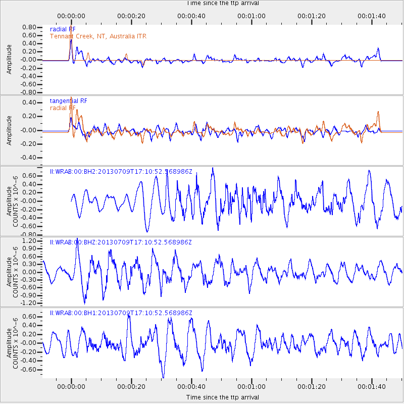
WRAB Tennant Creek, NT, Australia - Earthquake Result Viewer
*The percent match for this event was below the threshold and hence no stack was calculated.
| Earthquake location: |
Southern Sumatra, Indonesia |
| Earthquake latitude/longitude: |
-3.4/100.5 |
| Earthquake time(UTC): |
2013/07/09 (190) 17:04:15 GMT |
| Earthquake Depth: |
18 km |
| Earthquake Magnitude: |
5.5 MW, 5.6 MW, 5.6 MB |
| Earthquake Catalog/Contributor: |
NEIC PDE/NEIC PDE-W |
|
| Network: |
II Global Seismograph Network (GSN - IRIS/IDA) |
| Station: |
WRAB Tennant Creek, NT, Australia |
| Lat/Lon: |
19.93 S/134.36 E |
| Elevation: |
366 m |
|
| Distance: |
36.9 deg |
| Az: |
119.167 deg |
| Baz: |
292.096 deg |
| Ray Param: |
$rayparam |
*The percent match for this event was below the threshold and hence was not used in the summary stack. |
|
| Radial Match: |
51.736843 % |
| Radial Bump: |
400 |
| Transverse Match: |
52.66361 % |
| Transverse Bump: |
400 |
| SOD ConfigId: |
512894 |
| Insert Time: |
2013-09-15 17:14:26.815 +0000 |
| GWidth: |
2.5 |
| Max Bumps: |
400 |
| Tol: |
0.001 |
|
Signal To Noise
| Channel | StoN | STA | LTA |
| II:WRAB:00:BHZ:20130709T17:10:52.568986Z | 2.1957574 | 6.537046E-7 | 2.977126E-7 |
| II:WRAB:00:BH1:20130709T17:10:52.568986Z | 0.72054523 | 2.3347899E-7 | 3.24031E-7 |
| II:WRAB:00:BH2:20130709T17:10:52.568986Z | 1.6999356 | 3.3376986E-7 | 1.9634265E-7 |
| Arrivals |
| Ps | |
| PpPs | |
| PsPs/PpSs | |


