You are here: Home > Network List > IU - Global Seismograph Network (GSN - IRIS/USGS) Stations List
> Station HNR Honiara, Solomon Islands > Earthquake Result Viewer
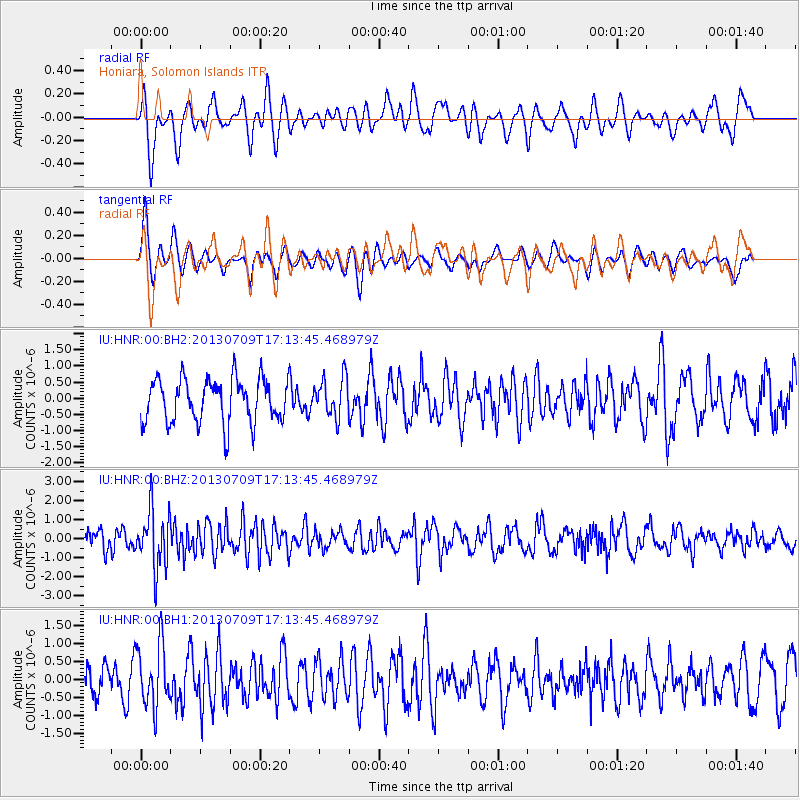
HNR Honiara, Solomon Islands - Earthquake Result Viewer
*The percent match for this event was below the threshold and hence no stack was calculated.
| Earthquake location: |
Southern Sumatra, Indonesia |
| Earthquake latitude/longitude: |
-3.4/100.5 |
| Earthquake time(UTC): |
2013/07/09 (190) 17:04:15 GMT |
| Earthquake Depth: |
18 km |
| Earthquake Magnitude: |
5.5 MW, 5.6 MW, 5.6 MB |
| Earthquake Catalog/Contributor: |
NEIC PDE/NEIC PDE-W |
|
| Network: |
IU Global Seismograph Network (GSN - IRIS/USGS) |
| Station: |
HNR Honiara, Solomon Islands |
| Lat/Lon: |
9.44 S/159.95 E |
| Elevation: |
100 m |
|
| Distance: |
59.4 deg |
| Az: |
98.925 deg |
| Baz: |
271.675 deg |
| Ray Param: |
$rayparam |
*The percent match for this event was below the threshold and hence was not used in the summary stack. |
|
| Radial Match: |
74.940895 % |
| Radial Bump: |
400 |
| Transverse Match: |
58.312504 % |
| Transverse Bump: |
400 |
| SOD ConfigId: |
512894 |
| Insert Time: |
2013-09-15 17:14:55.306 +0000 |
| GWidth: |
2.5 |
| Max Bumps: |
400 |
| Tol: |
0.001 |
|
Signal To Noise
| Channel | StoN | STA | LTA |
| IU:HNR:00:BHZ:20130709T17:13:45.468979Z | 3.756158 | 1.5280641E-6 | 4.068157E-7 |
| IU:HNR:00:BH1:20130709T17:13:45.468979Z | 1.3173484 | 8.737631E-7 | 6.6327414E-7 |
| IU:HNR:00:BH2:20130709T17:13:45.468979Z | 0.9127709 | 6.16991E-7 | 6.759538E-7 |
| Arrivals |
| Ps | |
| PpPs | |
| PsPs/PpSs | |


