You are here: Home > Network List > TA - USArray Transportable Network (new EarthScope stations) Stations List
> Station P54A Burton, WV, USA > Earthquake Result Viewer
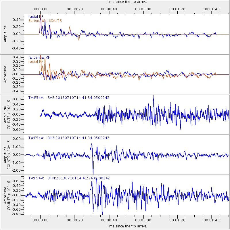
P54A Burton, WV, USA - Earthquake Result Viewer
*The percent match for this event was below the threshold and hence no stack was calculated.
| Earthquake location: |
Northern Chile |
| Earthquake latitude/longitude: |
-19.3/-69.2 |
| Earthquake time(UTC): |
2013/07/10 (191) 14:32:12 GMT |
| Earthquake Depth: |
110 km |
| Earthquake Magnitude: |
5.7 MW, 5.6 MW, 5.7 MB |
| Earthquake Catalog/Contributor: |
NEIC PDE/NEIC PDE-W |
|
| Network: |
TA USArray Transportable Network (new EarthScope stations) |
| Station: |
P54A Burton, WV, USA |
| Lat/Lon: |
39.61 N/80.48 W |
| Elevation: |
473 m |
|
| Distance: |
59.5 deg |
| Az: |
349.947 deg |
| Baz: |
167.677 deg |
| Ray Param: |
$rayparam |
*The percent match for this event was below the threshold and hence was not used in the summary stack. |
|
| Radial Match: |
77.31806 % |
| Radial Bump: |
400 |
| Transverse Match: |
51.391846 % |
| Transverse Bump: |
400 |
| SOD ConfigId: |
512894 |
| Insert Time: |
2013-09-15 18:04:46.348 +0000 |
| GWidth: |
2.5 |
| Max Bumps: |
400 |
| Tol: |
0.001 |
|
Signal To Noise
| Channel | StoN | STA | LTA |
| TA:P54A: :BHZ:20130710T14:41:34.050024Z | 4.0364375 | 2.5954392E-7 | 6.4300245E-8 |
| TA:P54A: :BHN:20130710T14:41:34.050024Z | 1.4708873 | 9.0565E-8 | 6.1571676E-8 |
| TA:P54A: :BHE:20130710T14:41:34.050024Z | 1.8801596 | 1.1768647E-7 | 6.259387E-8 |
| Arrivals |
| Ps | |
| PpPs | |
| PsPs/PpSs | |


