You are here: Home > Network List > IU - Global Seismograph Network (GSN - IRIS/USGS) Stations List
> Station PMG Port Moresby, New Guinea > Earthquake Result Viewer
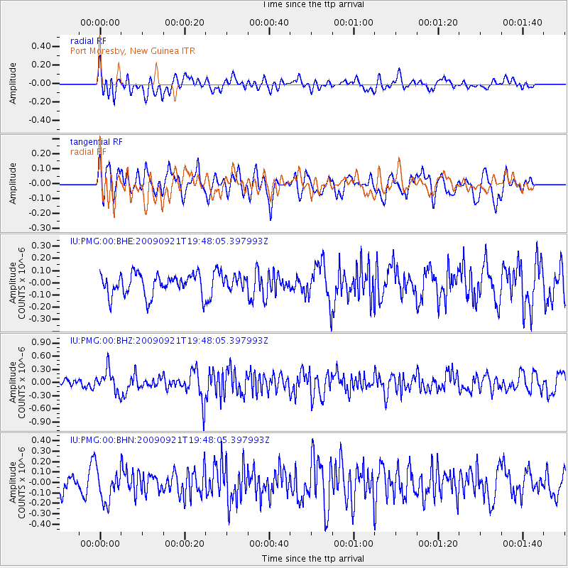
PMG Port Moresby, New Guinea - Earthquake Result Viewer
*The percent match for this event was below the threshold and hence no stack was calculated.
| Earthquake location: |
Myanmar |
| Earthquake latitude/longitude: |
20.4/94.8 |
| Earthquake time(UTC): |
2009/09/21 (264) 19:38:42 GMT |
| Earthquake Depth: |
84 km |
| Earthquake Magnitude: |
5.6 MB, 5.7 MW, 5.6 MW |
| Earthquake Catalog/Contributor: |
WHDF/NEIC |
|
| Network: |
IU Global Seismograph Network (GSN - IRIS/USGS) |
| Station: |
PMG Port Moresby, New Guinea |
| Lat/Lon: |
9.40 S/147.16 E |
| Elevation: |
90 m |
|
| Distance: |
59.4 deg |
| Az: |
114.802 deg |
| Baz: |
300.351 deg |
| Ray Param: |
$rayparam |
*The percent match for this event was below the threshold and hence was not used in the summary stack. |
|
| Radial Match: |
66.62868 % |
| Radial Bump: |
400 |
| Transverse Match: |
65.916824 % |
| Transverse Bump: |
400 |
| SOD ConfigId: |
1 |
| Insert Time: |
2010-02-19 00:18:31.065 +0000 |
| GWidth: |
2.5 |
| Max Bumps: |
400 |
| Tol: |
0.001 |
|
Signal To Noise
| Channel | StoN | STA | LTA |
| IU:PMG:00:BHZ:20090921T19:48:05.397993Z | 2.326018 | 2.6376577E-7 | 1.13397995E-7 |
| IU:PMG:00:BHN:20090921T19:48:05.397993Z | 1.4807065 | 1.4524208E-7 | 9.808972E-8 |
| IU:PMG:00:BHE:20090921T19:48:05.397993Z | 0.58600485 | 5.2178763E-8 | 8.904152E-8 |
| Arrivals |
| Ps | |
| PpPs | |
| PsPs/PpSs | |


