You are here: Home > Network List > TA - USArray Transportable Network (new EarthScope stations) Stations List
> Station V46A Holladay, TN, USA > Earthquake Result Viewer
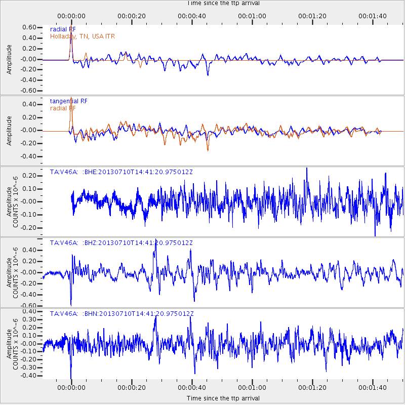
V46A Holladay, TN, USA - Earthquake Result Viewer
*The percent match for this event was below the threshold and hence no stack was calculated.
| Earthquake location: |
Northern Chile |
| Earthquake latitude/longitude: |
-19.3/-69.2 |
| Earthquake time(UTC): |
2013/07/10 (191) 14:32:12 GMT |
| Earthquake Depth: |
110 km |
| Earthquake Magnitude: |
5.7 MW, 5.6 MW, 5.7 MB |
| Earthquake Catalog/Contributor: |
NEIC PDE/NEIC PDE-W |
|
| Network: |
TA USArray Transportable Network (new EarthScope stations) |
| Station: |
V46A Holladay, TN, USA |
| Lat/Lon: |
35.80 N/88.12 W |
| Elevation: |
162 m |
|
| Distance: |
57.6 deg |
| Az: |
341.867 deg |
| Baz: |
158.802 deg |
| Ray Param: |
$rayparam |
*The percent match for this event was below the threshold and hence was not used in the summary stack. |
|
| Radial Match: |
71.233154 % |
| Radial Bump: |
400 |
| Transverse Match: |
54.81706 % |
| Transverse Bump: |
400 |
| SOD ConfigId: |
512894 |
| Insert Time: |
2013-09-15 18:09:19.869 +0000 |
| GWidth: |
2.5 |
| Max Bumps: |
400 |
| Tol: |
0.001 |
|
Signal To Noise
| Channel | StoN | STA | LTA |
| TA:V46A: :BHZ:20130710T14:41:20.975012Z | 3.5207653 | 1.6903203E-7 | 4.8010026E-8 |
| TA:V46A: :BHN:20130710T14:41:20.975012Z | 2.4815936 | 1.024922E-7 | 4.130096E-8 |
| TA:V46A: :BHE:20130710T14:41:20.975012Z | 1.1313922 | 5.6926318E-8 | 5.0315283E-8 |
| Arrivals |
| Ps | |
| PpPs | |
| PsPs/PpSs | |


