
SSW Satsop (broad-band) - Earthquake Result Viewer
| ||||||||||||||||||
| ||||||||||||||||||
| ||||||||||||||||||
|
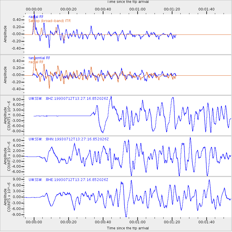
Signal To Noise
| Channel | StoN | STA | LTA |
| UW:SSW: :BHN:19930712T13:27:16.852026Z | 3.6094742 | 1.8290157E-7 | 5.0672636E-8 |
| UW:SSW: :BHE:19930712T13:27:16.852026Z | 4.5252423 | 2.1449195E-7 | 4.7399E-8 |
| UW:SSW: :BHZ:19930712T13:27:16.852026Z | 18.762627 | 7.708584E-7 | 4.108478E-8 |
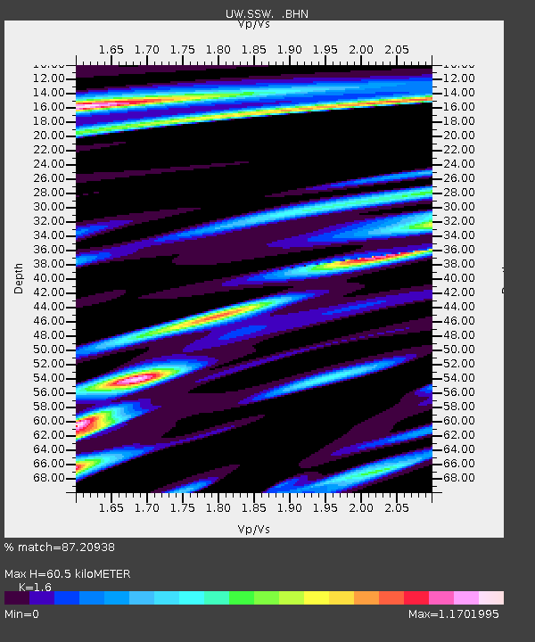
| Arrivals | |
| Ps | 5.8 SECOND |
| PpPs | 23 SECOND |
| PsPs/PpSs | 29 SECOND |

