SSW Satsop (broad-band) - Earthquake Result Viewer
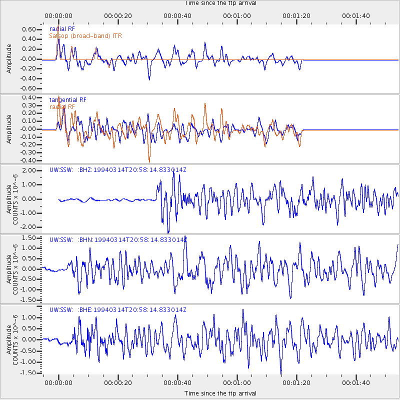
Earthquake location: Mexico-Guatemala Border Region
Earthquake latitude/longitude: 16.0/-92.4
Earthquake time(UTC): 1994/03/14 (073) 20:51:25 GMT
Earthquake Depth: 169 km
Earthquake Magnitude: 5.9 MB, 6.2 MS, 6.9 UNKNOWN, 6.2 MD
Earthquake Catalog/Contributor: WHDF/NEIC
Network: UW Pacific Northwest Regional Seismic Network
Station: SSW Satsop (broad-band)
Lat/Lon: 46.97 N/123.43 W
Elevation: 120 m
Distance: 40.2 deg
Az: 326.846 deg
Baz: 129.812 deg
Ray Param: 0.07390771
Estimated Moho Depth: 14.25 km
Estimated Crust Vp/Vs: 1.88
Assumed Crust Vp: 6.566 km/s
Estimated Crust Vs: 3.502 km/s
Estimated Crust Poisson's Ratio: 0.30
Radial Match: 81.58617 %
Radial Bump: 400
Transverse Match: 66.05817 %
Transverse Bump: 400
SOD ConfigId: 16938
Insert Time: 2010-02-27 05:01:16.586 +0000
GWidth: 2.5
Max Bumps: 400
Tol: 0.001

Signal To Noise

ChannelStoNSTALTA
UW:SSW: :BHN:19940314T20:58:14.833014Z1.86651181.6406337E-78.789838E-8
UW:SSW: :BHE:19940314T20:58:14.833014Z1.02342621.2324047E-71.204195E-7
UW:SSW: :BHZ:19940314T20:58:14.833014Z8.0796315.530034E-76.8444145E-8
Arrivals
Ps2.0 SECOND
PpPs5.8 SECOND
PsPs/PpSs7.9 SECOND