
SSW Satsop (broad-band) - Earthquake Result Viewer
| ||||||||||||||||||
| ||||||||||||||||||
| ||||||||||||||||||
|
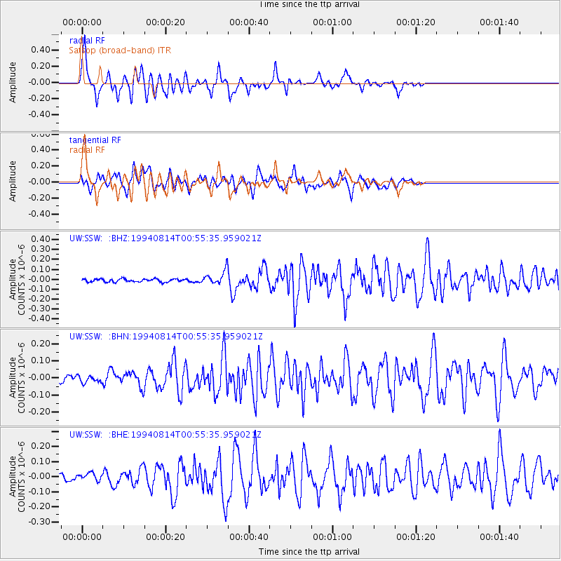
Signal To Noise
| Channel | StoN | STA | LTA |
| UW:SSW: :BHN:19940814T00:55:35.959021Z | 0.74872714 | 1.9057914E-8 | 2.5453751E-8 |
| UW:SSW: :BHE:19940814T00:55:35.959021Z | 1.0987604 | 2.3737323E-8 | 2.1603732E-8 |
| UW:SSW: :BHZ:19940814T00:55:35.959021Z | 4.644202 | 6.888796E-8 | 1.4833108E-8 |
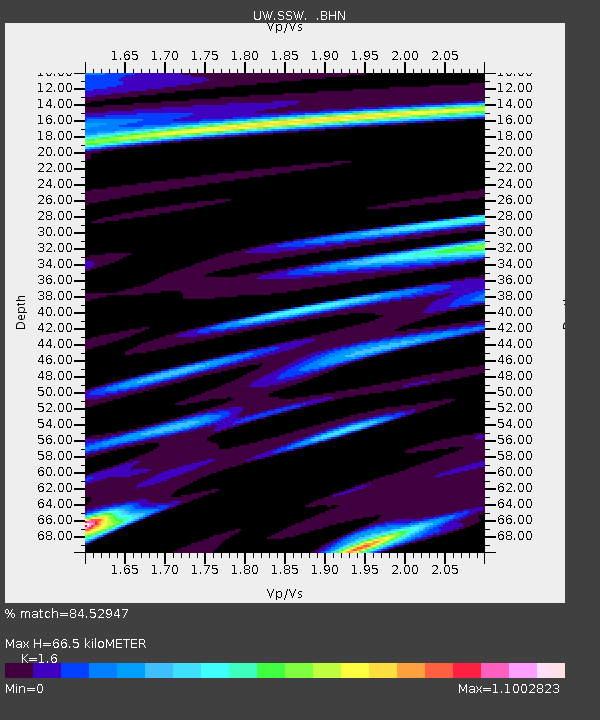
| Arrivals | |
| Ps | 6.4 SECOND |
| PpPs | 25 SECOND |
| PsPs/PpSs | 31 SECOND |

